As an update from my previous post yesterday, the warm front that is one of the drivers for the severe weather outbreak expected this weekend across the U.S. Heartland, will move northward Saturday night and settle over the middle half of Minnesota on Sunday as an area of low pressure navigates towards the area. This shift will raise temperatures well into the 70s behind the front, and along with it, transport humid, tropical Gulf moisture with dew points into the 60s.
Early Sunday morning, the air mass is forecasted to become moderately unstable as CAPE values reach 2000 J/kg.
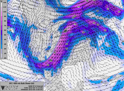
Bulk wind shear values in excess of 60 knots from the surface to 500 millibars will more than support a severe weather event.
With this kind of wind velocity, my worst fears are being confirmed. There will be an overnight tornado threat going into the day Sunday. Below is a “tornado index” between 1 a.m. and 1 p.m. Sunday. Make sure to have your NOAA Weather Radio ready and the alert function turned on. If you are an iPhone user, now is the time to have iMap Weather Radio installed!
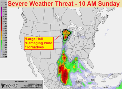
In the Upper Midwest, here is where the greatest threat for severe thunderstorms will be found during the mid-morning on Sunday. All modes of severe weather will be possible – large hail, damaging winds, and tornadoes.
Follow www.stormchaserschwartz.com all weekend long for additional updates!
RS


The only good thing about this potential outbreak is it could occur during daylight.
ReplyDeleteAgreed. It's one of those sick feelings looking at the charts and seeing the worse case is during the overnight.
Delete