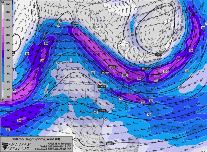
Over a span of a few days, our weather will turn from mild and dry to chilly as temperatures Tuesday morning drop below freezing across much of the state. Around the Twin Cities, I do think some spots will see temps below 32 degrees at times. Seems like I have been talking about everything but storms lately. Then again, it is still early April despite the warm climate pattern.
A Freeze Watch has been issued by the National Weather Service from 1 AM to 10 AM Tuesday for the counties noted below.
Why is this happening? The jet stream will dip a bit south from Canada and pull in a strong northwest flow of Arctic air.
Both the European and NAM models are calling for temps below 30 degrees. The downtown areas of Minneapolis and St. Paul may be close to the freezing point.
By the end of the week, a warm up takes place and the threat for frost and freeze in the Twin Cities for the week will be gone.
RS


No comments:
Post a Comment