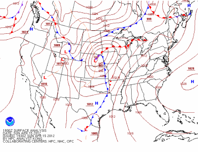
My first real storm chase of the year. Severe thunderstorms were expected on Sunday, April 15th, as warm, moist air was to surge northward out ahead of a cold front and behind a warm front lifting through south-central Minnesota.
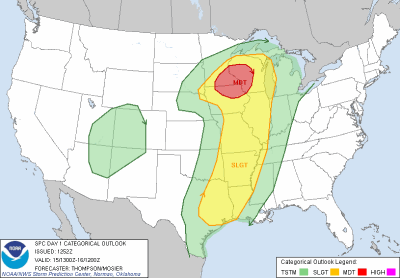
The Storm Prediction Center was confident that a severe weather event would take place that it issued a moderate risk of severe thunderstorms Sunday morning across southeastern Minnesota, as well as portions of Wisconsin, and Iowa.
Wind shear profile were favorable for the development of tornadoes, some of which could have been strong.
From the SPC forecast discussion:
CURRENT THINKING IS THAT THE GREATEST SEVERE CERTAINTY/POTENTIAL CONCENTRATION WILL BE TO THE EAST-NORTHEAST OF THE NORTHEASTWARD ADVANCING SURFACE LOW NEAR WHERE IT INTERSECTS THE WARM FRONT/ADJACENT WARM SECTOR...WITH POSSIBLE OUTFLOW AUGMENTATION AS WELL. ROBUST DEEP LAYER WIND FIELDS...WITH STRONG/ELONGATED LOW LEVEL HODOGRAPHS AND VERY DEEP LAYER SHEAR EASILY ON THE ORDER OF 50+ KT...WILL LIKELY SUPPORT AN INITIAL SEMI-DISCRETE MODE OF FAST NORTHEASTWARD-MOVING SUPERCELLS WITH AN EVOLUTION TO FAST LINE SEGMENTS/BOWS. ACCORDINGLY...ALL SEVERE HAZARDS APPEARS POSSIBLE...INCLUDING THE POSSIBILITY OF TORNADOES...SEVERE HAIL...IN ADDITION TO POSSIBLE SWATHS OF WIND DAMAGE BY LATE AFTERNOON INTO EVENING ACROSS THE UPPER MS VALLEY. TORNADO POTENTIAL /PERHAPS A FEW STRONG/ WILL LIKELY BE HEIGHTENED NEAR/NORTHEAST OF THE SURFACE LOW AND WARM FRONT/PERHAPS RESIDUAL EARLY DAY OUTFLOW.
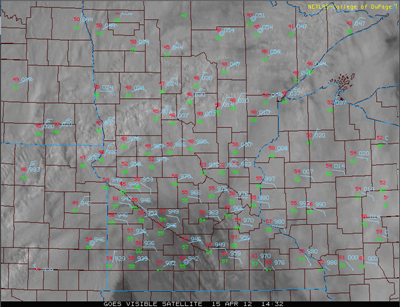
Morning cloudiness really hindered the ability to get a full day of heating to create enough instability for thunderstorms. This was the concern I had all day, and putting me on the fence as to whether I was going to go out and chase. Another problem I eventually saw was that winds were out of the south-southeast instead of the south, which prevented the really rich Gulf moisture from getting here. Dew points at the height of the severe weather were in the low 60s and relative humidity levels in the 60 to 70 percent range outside of the thunderstorms. Good, but not terribly impressive.
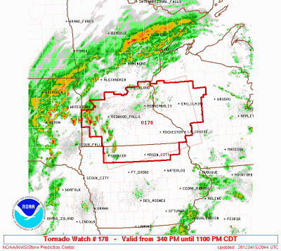
By afternoon, some clearing was able to take place and the sun broke through. At 3:40 PM, a tornado watch was issued for a good portion of southern Minnesota, with thunderstorm activity expected to develop over southwestern Minnesota and spread east throughout the day.
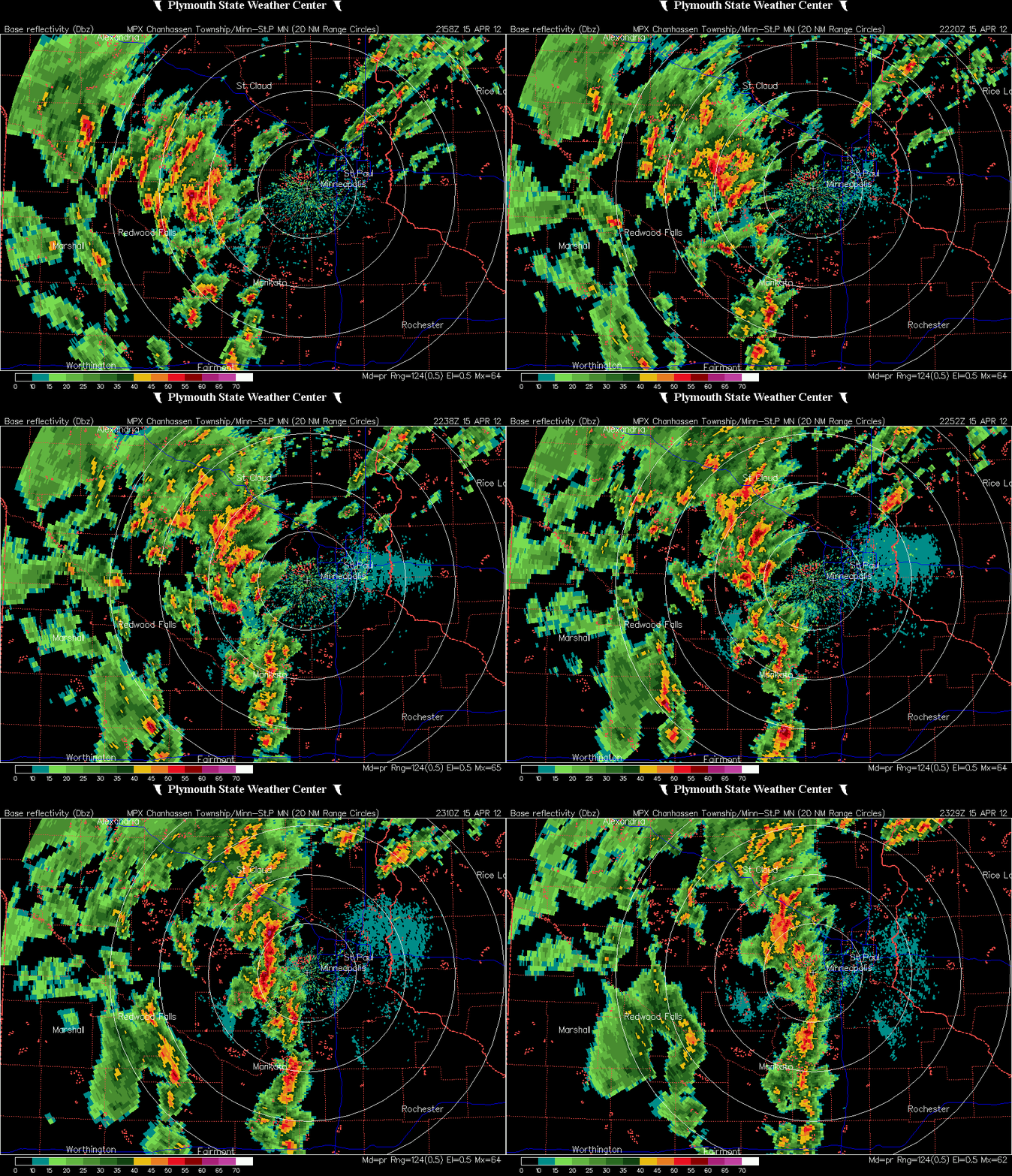
More storms fired during the afternoon and moved north. Despite thinking this setup didn’t have much promise even with a moderate risk and tornado watch, I decided to head west from Eden Prairie and make a play on storms traveling through McLeod County near Glencoe.
As I was heading towards Glencoe on US-212 from the east, I saw this nice cloud formation with an inflow tail on the south side of the highway. It lasted a couple minutes and then dissipated. Perhaps it was the most interesting feature I saw on the whole chase. It may be difficult to see in the video below. All I had going was a low-res streaming dash cam.
As I passed Glencoe, an interesting hook echo appeared on radar just south of the town of Biscay around 5:20 PM. I got north on Minnesota State Highway 22 to get on the storm, but found myself about 5 miles out (as the crow flies) from town when a tornado was reported at 5:24 PM, which is when this radar image scan below was taken. Noted is my position as recorded by Spotter Network at 5:24 PM.
AT 524 PM CDT...TRAINED WEATHER SPOTTERS REPORTED A TORNADO. THIS TORNADO WAS LOCATED NEAR BISCAY...OR 7 MILES SOUTHEAST OF HUTCHINSON...MOVING NORTH AT 45 MPH.
I headed north from Biscay on McLeod County Road 4 in hopes of catching a glimpse of the twister to my east over open country, but alas, no dice.
I ran into Minnesota State Highway 7 and headed back east. On Highway 7, I took Carver County Road 30 into New Germany, and eventually Mayer. Saw a lot of low topped clouds with rain on this trip, and not a whole lot of lightning. Between New Germany and Mayer, I ran into a sheet of heavy rain and pea size hail. The intensity of the storms dwindled as I patronized Carver County, so I decided to call it a day until I bit on some redeveloping storms over Eden Prairie. I decided to chase those until north of the Interstate 494/US-169 intersection into Edina on US-169 before turning around and finally calling it a day. By then, the tornado watch box was being dropped from west to east pretty quickly. Most of the Twin Cities was out of the watch box by 8 PM or so, if I recall correctly.
For an elevated risk of severe thunderstorms this day, there was not a lot of severe weather to be found. There were just too many things working against severe storm development. I felt a little letdown, but going in I wasn’t expecting too much this day. My April chases haven’t been much luck anyway. This wasn’t the most photogenetic chase, as I didn’t even get out of the car at all to snap photos, which is unusual for me during the daytime. It would have been nice to see a tornado over open country, in an unpopulated area. For the Twin Cities sake, I’m glad nothing happened here.
There were just three tornado reports, and a report of one-inch size hail in Glencoe. A couple funnel clouds reports thrown into the mix as well. Fortunately, the tornadoes occurred over open land, and no injuries or damage was reported.
Using my Spotter Network location tracking log, here is where I traveled on this chase:
Total severe reports: 0
RS



No comments:
Post a Comment