I can’t believe that I’m actually writing a blog entry on what went wrong (read: bust) with the severe weather set up on Saturday, considering that everything was in place going into the day for a potentially explosive event. Instability was off the charts, there was a cold front, with good temperature contrast, moving through to provide lift, and favorable wind shear for some rotating supercells.
Don’t get wrong, I’m glad nothing major happened close to the Minneapolis-St. Paul metro area with the Twins game played during the afternoon and followed by the U2 concert at night. Chalk it up to another goofy weather day in 2011. I’ve never seen a spring/summer storm season as bizarre as this one. You might as well throw out the textbooks this year, because the classic set ups for storms just don’t seem to work this year. Many head-scratching moments.
I have two theories that prevented a severe weather outbreak yesterday:
1. Morning convection
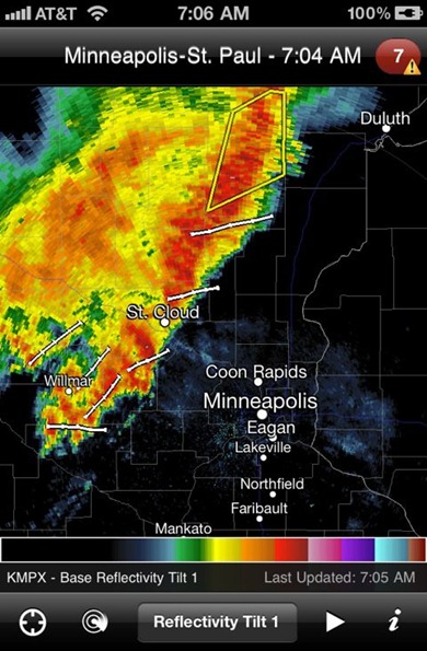
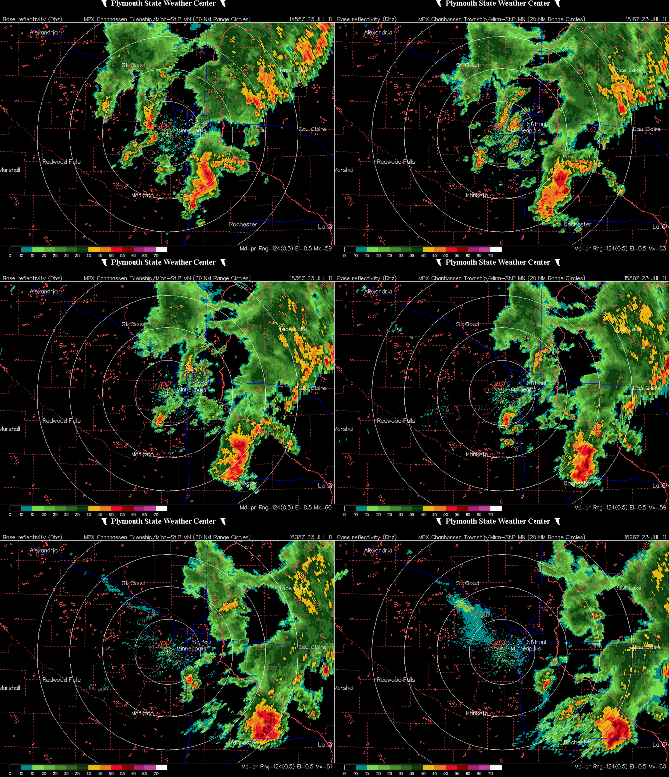
During the morning hours, a line of thunderstorms moved through central and southern Minnesota. Some of the stronger storms produced hail up to 1.25-inches near Cold Spring in the St. Cloud area, and winds strong enough to down trees across the southeast part of the state.
Radar image of the storms just after 7 AM Saturday:
Radar summary of the line of storms moving across southern Minnesota during the morning hours:
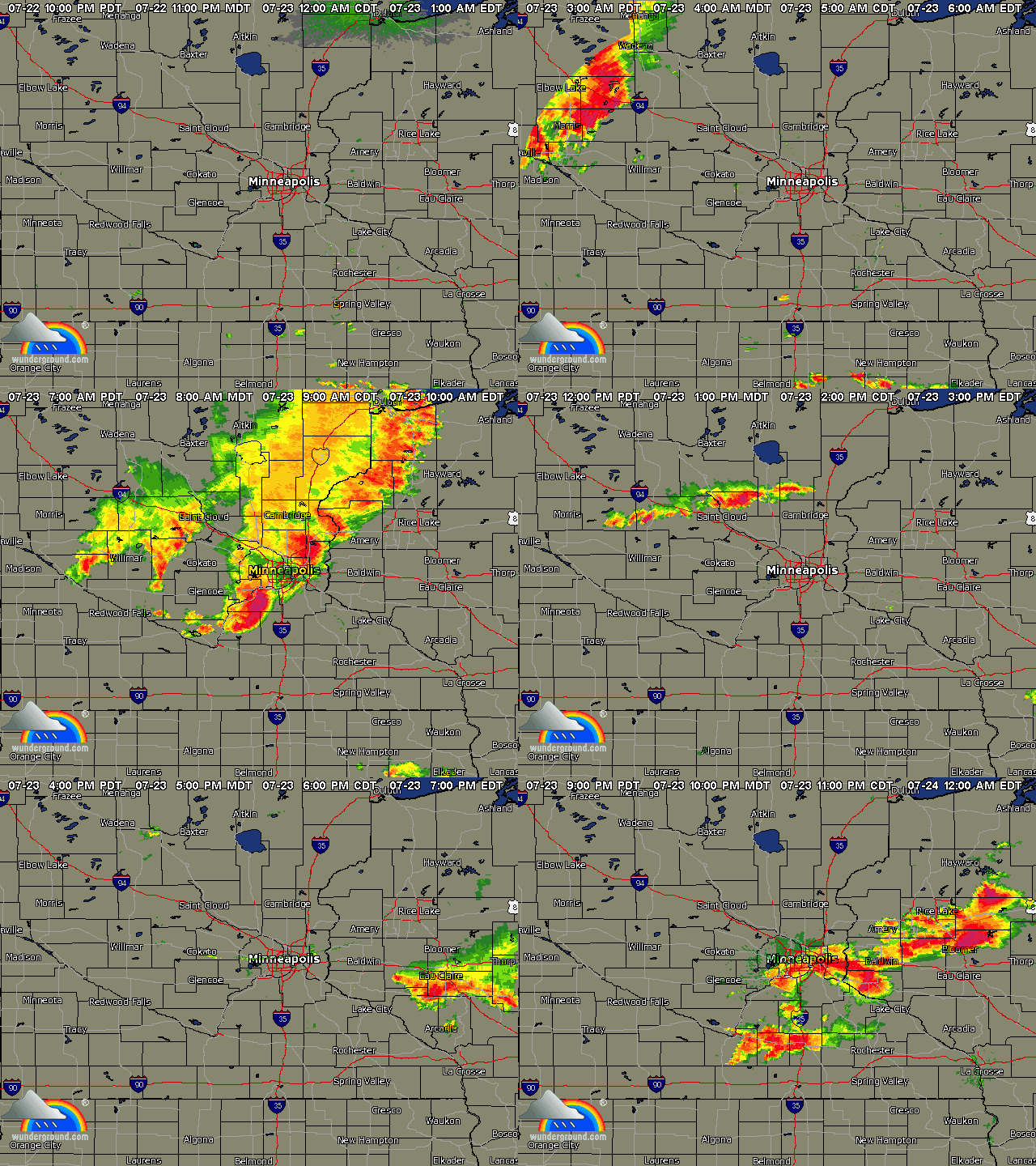
These initial storms created boundaries – pockets of cooler air trapped in the atmosphere, which can be tapped for later storm development. This would throw a wrench into forecasting the intensity and coverage of thunderstorms for later in the day. Here’s the radar summary from the entire day. Notice how storms develop late in the day near the metro in the area where the morning storms occurred:
2. Cloud cover
After the storms had passed in the morning, I made the decision around 12:30 PM to drive west on US-212 towards Olivia, and north on US-71 to Willmar, thinking there would be some decent storm development during the afternoon with no cloud cover to interrupt diurnal heating.
It was looking so promising before 2 PM that even the Storm Prediction Center (SPC) was indicating the likelihood of a weather watch box being issued – probably a tornado watch, based on the red outline the SPC used for the southern half of Minnesota and portions of Iowa and South Dakota. In the world of weather, tornado watches are sometimes referred to as “red boxes” and severe thunderstorm watches are “blue boxes”.

My hopes of seeing a supercell and perhaps a tornado quickly vanished about an hour later as I could see a cloud layer, with no precipitation, off in the distance that formed and was moving to the east as I got closer to Olivia. This pretty much killed any severe weather threat for the day as the clouds would cap any serious storms from firing.
That’s just a brief summary of what took place yesterday that nullified the severe weather threat. It’s difficult to win over people when I was promoting the likelihood of severe weather during the day and nothing happened. Hopefully, I didn’t alter your plans too much for nothing. It’s just one of those frustrating days as to why things don’t work out the way they should have on paper.
RS


Nice summary of what happened. I was headed west thinking i would meet up with you, but you started heading north and I decided to go south thinking I could get away from that cloudy soup that rolled in. I never saw a storm, though some small ones did go late in the evening, they were well covered by other chasers, so I headed home, got a few nice sunset shots on the way.
ReplyDeleteCertainly was a frustrating, but interesting day on Saturday.
ReplyDeleteVery interesting. Fun entry. I was at Menomonie Park in Oshkosh, WI watching a Regatta. I was encouraging the clouds to build as the sun was just too hot. Some clouds did move in after the races and we received another early morning thundershower.
ReplyDelete