Saturday was an interesting day for thunderstorm activity. Morning storms over northern Minnesota, triggered by a slow-moving cold front, really wreaked havoc on the forecast for the remainder of the day due to the complexities of the situation with cloud clover and boundaries established from previous storms. If I can be honest, it was one of those days where I really had no idea where storms would fire, and if they would become severe. I like being straight-forward with people, and I’ll be the first to admit I was wrong about something. I knew the possibility of storms across the northland in the morning, which would eliminate the greatest threat for severe weather over that area where upper-level winds were the strongest for organized storms.
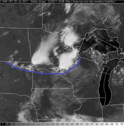
Here a satellite image from around the noon hour Saturday. With the cloud cover, the best chance for any severe storms appeared to be over the southern half of Minnesota.
The National Weather Service in Chanhassen put together this illustration showing the position of fronts and boundaries later in the day at approximately 4:45 PM:

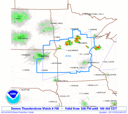
The Storm Prediction Center wasn’t really sure about this day either. It had issued a severe thunderstorm watch during the early afternoon hours until 9 PM for southern Minnesota, then cancelled it soon after, and re-issued another watch in the evening until 1 AM Sunday.
Initial severe thunderstorm watch:
The “do-over” of the watch:
With all the complications to the forecast, and with the storms working in a weaker wind environment, I decided against storm chasing in the afternoon, and instead worked on some projects around home. Although it’s an interesting puzzle to attempt to solve, I didn’t want to sit around idle and wait to see what would happen, if anything did. With the price of gas these days, it just didn’t make a lot of sense for this level of uncertainty either.
First storms arrive into the Brainerd lakes area before 6 PM:
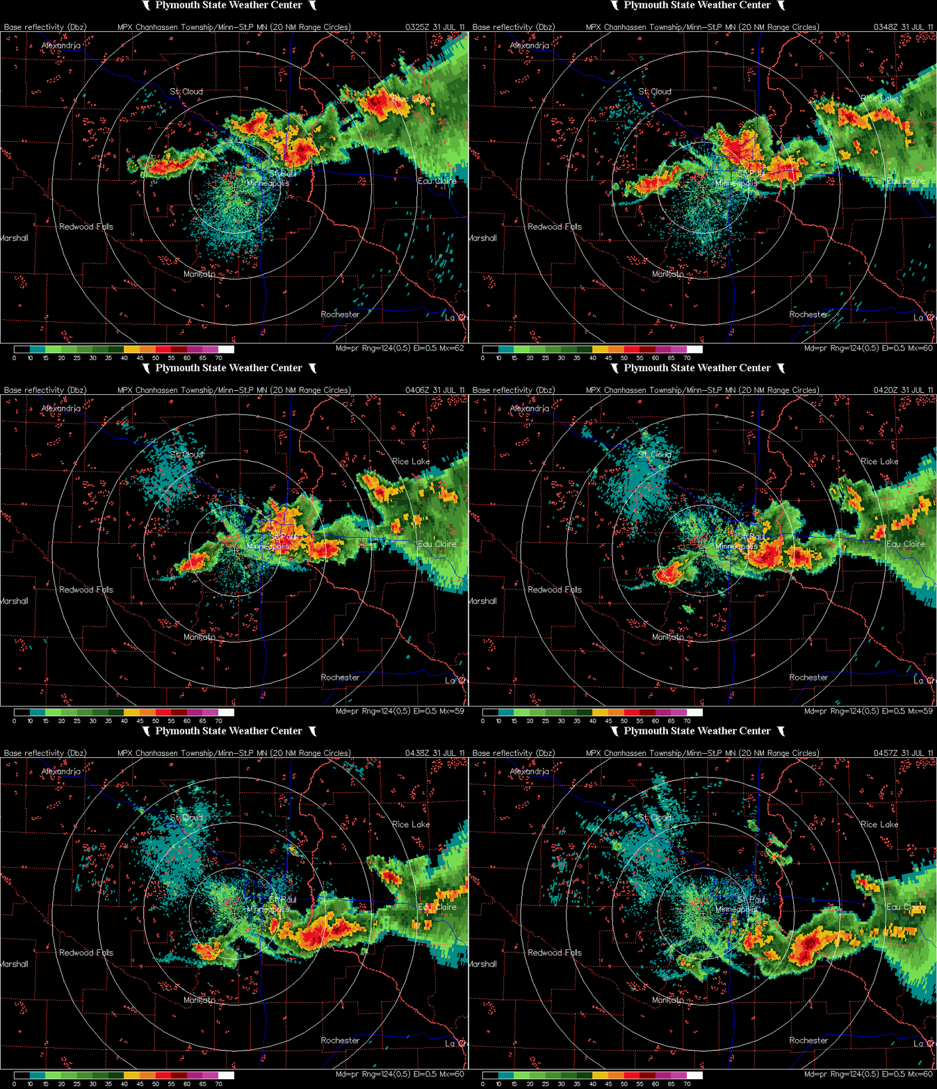
As the storms moved to the southeast from Brainerd, the most intense storms were over Mille Lacs and Isanti Counties, where numerous funnel clouds were reported. Here are radar summaries north of the Twin Cities from the National Weather Service.
Base reflectivity:

Base velocity:

Areas of the greatest rotation are indicated by the darker colors below. Based on what I saw on radar, I wouldn’t be surprised if there was a brief tornado touchdown near the Mille Lacs and Kanabec County border, east of Milaca. A storm survey is being conducted in this area to determine if there were tornadoes.
As day progressed into the night, I decided to make a play at the storms to the west of the “main event” after 10 PM.
I headed out west on Minnesota Highway 5 towards Carver County, and intercepted the storms in Norwood-Young America. Saw a pretty good lightning display from these garden-variety storms. I captured some video from my cell phone as I was driving around the town. The audio is WCCO Radio.
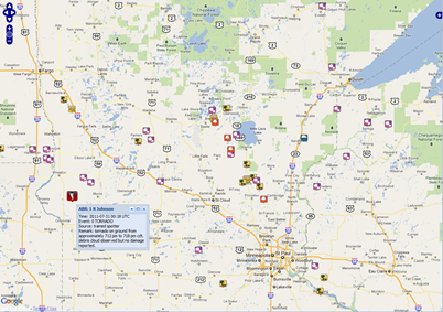
Severe storm reports from the day were scattered, with the most concentrated area from the cell that tracked southeast from Brainerd into the northern Twin Cities metro with large hail, felled trees from strong winds, and funnel clouds. One tornado was reported in the city of Johnson, Minnesota in far west-central Minnesota from a short-lived storm.
RS


I hung out near Litchfield for a while hoping for something to happen on the outflow boundary. After they canceled the first severe watch, I figured it was a bust, and headed over to my Dad's place in big lake for dinner. I was watching the storm coming down I 94 on the way there, and after supper headed out to St. Cloud to intercept. It was gusting out by the time I got there, but clear skies right behind the updraft helped me get some good structure and lightning shots.
ReplyDeleteNice Mike! Well, at least you got something out of it!
ReplyDelete