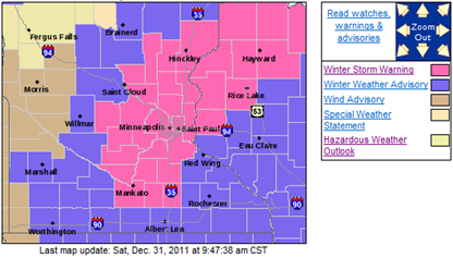
Much to my surprise this morning, on the final day of 2011, Winter Storm Warnings have been posted issued for a good portion of east central Minnesota into northwest Wisconsin.
- Winter Storm Warning valid at Dec 31, 9:00 PM CST for Anoka, Chisago, Dakota, Hennepin, Isanti, Le Sueur, Ramsey, Rice, Scott, Steele, Waseca, Washington [MN] and Barron, Polk, St. Croix [WI] till Jan 01, 6:00 AM CST
- Winter Storm Warning valid at Dec 31, 4:00 PM CST for Pine [MN] and Burnett, Douglas, Sawyer, Washburn [WI] till Jan 01, 12:00 PM CST
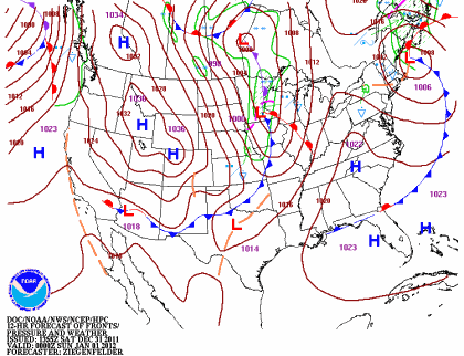
A low pressure center and associated cold front is expected to move on top of southern Minnesota by the evening hours, generating precipitation and gusty winds along with it.
This storm system is forecasted to have up to a half-inch of of liquid precipitation to work with. The precipitation will start as rain before changing over to snow by around midnight.
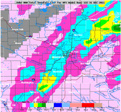
The latest NAM is spitting out generally one to three inches of snow across the Twin Cities.
This will be a wet snow, so I think a range of one to three inches of snow across the Twin Cities seems like a real possibility.
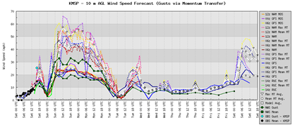
Winds will be kicking up towards midnight with sustained winds between 20-30 MPH with gusts to 40 MPH or higher! This will result in some blowing snow and reduced visibilities. Fortunately, we are not looking at a ton of snow, so it should not be too much of a problem.
Stay safe on this New Year Eve and don’t drive home drunk. Have a sober ride lined up. The weather conditions will be a challenge during the overnight for even the sober of drivers.
RS


No comments:
Post a Comment