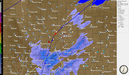
Our first significant snow of the season fell across Minnesota on a Saturday, and we will see another bout today. Snow is trying to fall across southern Minnesota, but appears to be evaporating before hitting the ground. No snow is being reported across southern Minnesota as of the noon hour.
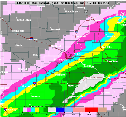
The forecast models have increased the snow a bit across the Twin Cities area. The NAM model has brought the snow band a bit further north and west and a good portion of the Twin Cities may see two to four inches of snow. The heaviest snow in the Cities will be southeast of the Minnesota River with one to two inches across the northwest and northern suburbs on the Twin Cities.
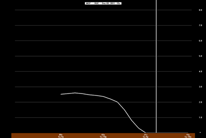
Using the RUC timing, accumulating snows should begin in the Twin Cities by 4 PM. Both short-term forecast models, the NAM and RUC, are indicating at least two inches of snow across the heart of the metro, so receiving at least that much is a safe bet. (Click to expand the image.)
NAM:
RUC:
For our friends across southeast Minnesota, around Rochester and Albert Lea, I still believe that a swath of four to six inches of snow is possible.
The National Weather Service elected to drop the Winter Storm Watch and went with a Winter Weather Advisory instead.
A Winter Weather Advisory is in effect until 6:00 AM Sunday for the following Minnesota counties: Anoka, Blue Earth, Brown, Carver, Chisago, Dakota, Dodge, Faribault, Fillmore, Freeborn, Goodhue, Hennepin, Le Sueur, Martin, Mower, Nicollet, Olmsted, Ramsey, Rice, Scott, Sibley, Steele, Wabasha, Waseca, Washington, Watonwan, and Winona.
RS


No comments:
Post a Comment