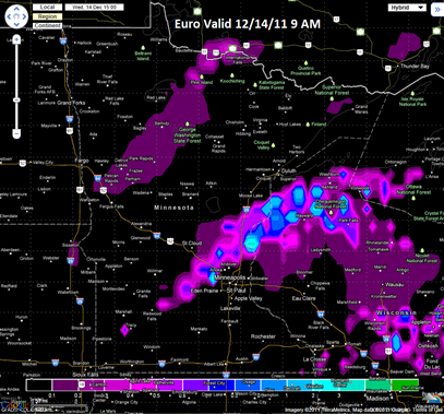
The storm event for Wednesday into Thursday is looking more and more like a rain producer. Some of the models have trended towards shifting a warm front into north central Minnesota, thus allowing precipitation from the approaching low pressure center to fall as rain. There will not be much snow associated with this, but central Minnesota and the northern parts of the Twin Cities could see some flakes late Wednesday into Thursday morning on the back side of this system as it exits to the east.
The NAM model shows the temperature profile being just above freezing (0°C) at the lowest 6000 feet in the atmosphere at 7 AM on Wednesday to melt any snow in the upper-levels of the atmosphere.
The SREF model also agrees with the precipitation type (p-type) as rain for Wednesday morning.
The European model suggests snow flurries Wednesday morning across the northern and western parts of the greater Twin Cities metro, but as of now, I’m not buying into this solution. I think we will be too warm to see any snow close to the Twin Cities to start the day.
It’s looking like this will be a missed opportunity to have a “white” Christmas, but I still believe it’s too soon to declare a “brown” Christmas this year. I will explain more in my next post.
RS


No comments:
Post a Comment