As I was reading various weather-related articles from local media and watching weather segments during television newscasts on Tuesday, there seems to be a scare that we could be in for a “brown” Christmas this year with the recent mild temperatures taking care of the current snow pack. A brown Christmas is defined as less than one inch of snow on the ground. As of December 12th, locations across the Arrowhead and southeastern Minnesota are still reporting a few inches of snow on the ground. The Twin Cities had one inch of snow.
Occasionally, we do have a Christmas when there is no snow on the ground. It’s not uncommon. Nearly three out of four Christmases in the Twin Cities have at least one inch of snow on the ground. The last time the Twin Cities had seen a brown Christmas was in 2006, so we are due for one. As the map below indicates, if you want to see a white Christmas, then your odds are generally better to head north.
We are less than two weeks away from Christmas, and I feel it’s too soon to write-off any snow yet for the holiday. For those wishing for snow, anxiety is beginning to kick in as we count down the days to the 25th. Forecasts can and do change rapidly, and sometimes snowstorms only appear three days out from the onset.
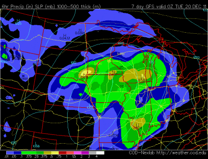
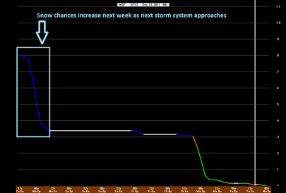
Another storm system we will need to pay attention to comes into play on Monday. This will be another system that will be teetering on the rain/snow line. The GFS model is showing the rain/snow line roughly south and east from the northern Twin Cities metro, to just southeast of St. Cloud, and extending south along Minnesota State Highway 15.
We could see accumulating snow with this system on Monday, but it’s still early to give precise estimates on amounts.
What happens late next week and still a mystery, but it will provide one last chance at snow before Christmas if we do not see anything significant before then. Stay tuned for more on this white Christmas suspense story!
RS


No comments:
Post a Comment