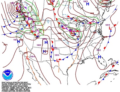
In what perhaps will be the final snowfall of 2011, several locations across the southern half of Minnesota may pick up at least an inch of snow by midday Friday as a couple low pressure areas and associated front drag across the region. Temperatures will slip just enough below the freezing point for snowflakes. We’re not talking anything significant (>4 inches) by any means.
Moisture content will be meager, with the heaviest of the snow falling across far southeastern Minnesota. The concentrated areas of snow will fall south of Interstate 94.
The European model picks up on the moisture in far southern Minnesota in determining snow amounts.
In Rochester, the models seem to be agreeing on an amount in the three to four inch range.
In the Twin Cities, expect lighter snow. Right now, I thinking generally most areas in the metro will see about two inches of snow will some isolated areas, mainly south, seeing up to two-and-a-half inches.
Expect a slow commute Friday morning. The timing of the snow appears to be in a window between midnight and 9 AM.
RS


No comments:
Post a Comment