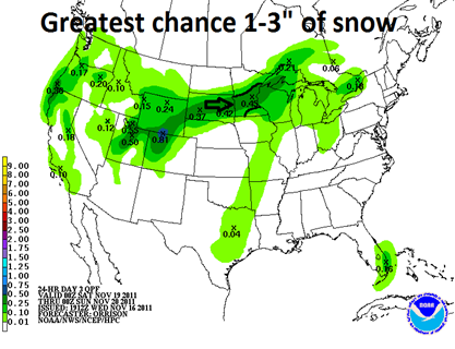
An update to the first measureable snow of the season that will impact areas of central and south central Minnesota during the weekend…
Over the last couple days, the forecast models have been shifting in different directions with the approaching low pressure area. The consistent trend that I have seen is that snow will fall across the central part of the state from St. Cloud to Brainerd to Duluth. The big question has been the impacts of the storm across the Twin Cities. The rain/snow dividing line is setting up to be very close to the metro. My current thinking is that the Twin Cities will see rain to start the day on Saturday, before changing over to snow Saturday night, based on the NAM temperature profiles. Areas to the north will see snow the majority of the day.
Based on my calculations, I’m expecting about a slushy inch of snow across the metro, and south to Mankato and Owatonna, while areas that see most of the snow could pick up as much as three inches. This will be a wet and heavy snow with snow ratios in the 5:1-8:1 range.
RS


No comments:
Post a Comment