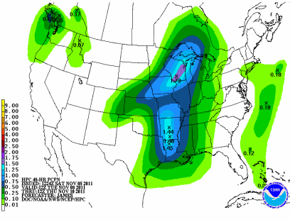
As early as Thursday morning, forecast models began to pick up on a low pressure system tracking across across the Upper Midwest from the southwest on Tuesday and Wednesday. Watching the various model runs over the last couple days, it’s appearing more likely that the low track will be to our east, across Wisconsin.
As it tracks across the region, it is expected to tap into Gulf of Mexico moisture to bring some respectable precipitation. At this time, it looks like Wisconsin will see the brunt of the storm.
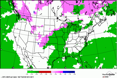
The rain/snow line may just cut through the southeastern Twin Cities metro. Right now, it appears that most of the precipitation will fall as rain from Rochester, MN to southern Wisconsin, but north central Wisconsin could see some snow out of this system. If the low tracks to the slightest bit to the west from an east coast ridge block, then I do think the Twin Cities could see a snow/rain mixture or snow out of this system. If it is all snow, then we could end up with one to two inches.
The snow (magenta)/rain (green) “battle field” sets up across Minnesota:
For now, you’ll probably be keeping the snowblowers in the garage, but stay tuned for updates on this system!
RS


No comments:
Post a Comment