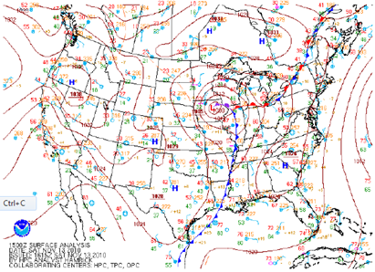
A little over a year ago today, the Twin Cities saw it’s first significant snowfall of the 2010-11 season from a low pressure system that developed across the southern United States, and moved from a northern Missouri to western Wisconsin position between the 12th and 14th of November. The track was one of a “Panhandle Hooker”. No, it’s not a dirty term - rather it’s a system that develops over the panhandle of Texas and Oklahoma. This was the largest pre-Thanksgiving snowfall for the Twin Cities since the Halloween Blizzard of 1991.
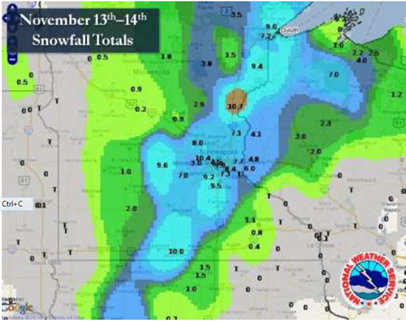
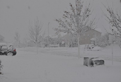
As I recall from a blog entry at the time, there was roughly a 48-hour advanced warning with this system as winter storm watches were issued on the 11th. The snow would begin late on the night of the 12th, and persist through the day on the 13th for much of central and southern Minnesota into northwestern Wisconsin. The snow ended in northeast Minnesota on the 14th. This storm left a blanket of snow about 100 miles wide from western Iowa, though south central Minnesota, and into the Arrowhead of Minnesota. The snow was wet and heavy from having a high moisture content level. It caused tree branches to snap, and resulted in power outages. Thunder and lightning accompanied the storm, and was observed across southern and eastern Minnesota during morning hours of the 13th.
The highest snow total reported in Minnesota was 12 inches near Maple Grove in Hennepin County. The National Weather Service Office in Duluth saw 10.6 inches. At Twin Cities International Airport, as well as my location in Shakopee, 8 inches of snow fell. Of the 8 inches at the airport, 7.7 inches was recorded on the 13th.
Additional reading:
- November 13th, 2010 Winter Storm from the National Weather Service – Twin Cities
- Heavy Snow in Eastern Minnesota - November 13-14, 2010 from the Minnesota Climatology Working Group
RS


No comments:
Post a Comment