A Winter Storm Watch has been issued from 6:00 PM CST Tuesday until 12:00 PM CST Wednesday for the following counties across Minnesota: Dodge, Fillmore, Houston, Mower, Olmsted, Wabasha, and Winona. The National Weather Service says six or more inches is possible in the watch area.
The storm system will move into southern Wisconsin by Wednesday with cold air, near freezing, wrapping into the moisture transport from the Gulf of Mexico. This will set the stage for snow behind the system across southeast Minnesota, and a good portion of Wisconsin.
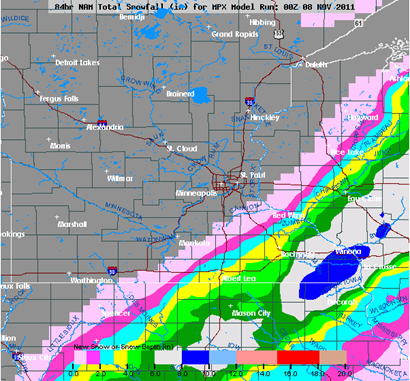
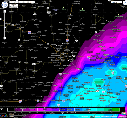
For forecasted snowfall totals, I am going on a blend of the NAM and European models.
NAM snowfall output:
European snowfall output:
Snow flurries may be mixed in with rain showers across the far southeastern corner of the Twin Cities metro, Dakota County in particular, by the morning on Wednesday, but the heaviest snow will be located across southeast Minnesota into Wisconsin. It appears areas from Red Wing to Rochester will see one to three inches of snow, while Rochester to La Crosse, Wisconsin will see larger amounts in the three to six inch range. Enough to shovel, and perhaps some early season work for the snow blowers!
RS


Ryan, that was a great forecast you put out, very similar to someone else I know. At the time you posted it was right on given the data that was available. Good Job!!
ReplyDeleteThanks Randy for stopping by and taking the time to comemnt. Everything was looking good with the storm, then just veered off to the east with the overnight convection in the south central part of the United States. Well, it was a good practice round I guess. :)
ReplyDelete