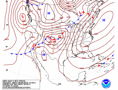
A low pressure area is expected to track northeastward that will bring a chance of snow across central Minnesota this weekend. The timing right now appears to be late Saturday into Sunday.
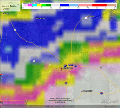
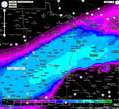
The cutoff for accumulating snow is setting up to be be right over the Twin Cities metro according to the GFS and European forecast models. It possible that some places across central Minnesota could pick up a half of foot of snow or more. It still a bit early to give exact snowfall estimates as the projected storm track may still shift between now and the weekend. Wouldn’t be surprised to see a dusting of snow across the Twin Cities, especially the northern suburbs.
GFS:
European:
Something to watch that may have an impact on weekend travel. Stay tuned!
RS


Ryan, as usual, very informative. This mornings run of the Euro has dropped the heaviest snow band south again, now it over the metro, that I believe is the effect of the cold air coming down from Canada. The question is will it drop further south?
ReplyDeleteThanks Randy. It seems like the models are meandering a bit on this one with the shifts to the north and south. Will be curious to see how the Euro looks on Wednesday with the GFS shift towards the north.
ReplyDelete