Just a quick update on the midweek storm system that may bring snow and rain to the area…
Part of the challenge is that there is no agreement between the forecast models. The American models (GFS and NAM) want to steer the storm track east over the Great Lakes region. The European and Canadian models want to take the track over southeast Minnesota. Another factor is the rain/snow line, and how close will it setup to the Twin Cities metro area.
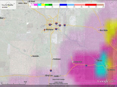
My current thinking is to keep the snow southeast of the Twin Cities into southeast Minnesota. Analyzing the dynamics, I’m not real impressed with the snow making ability of this system. Rochester is in line to pick up a coating to two inches of snow on the backside of the low pressure system. This accumulated snowfall image through Wednesday night summarizes how I see the event unfolding.
RS


No comments:
Post a Comment