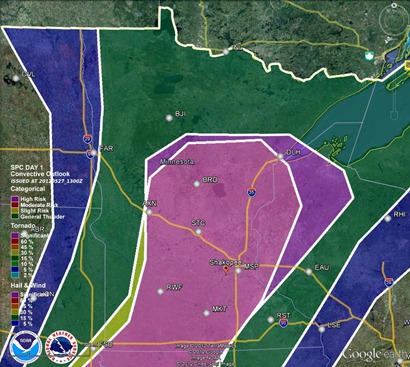
A lifting warm front and an advancing cold front will set the stage today for severe thunderstorms as temperatures reach the 90s across the southern two-thirds of Minnesota and tropical dew points near 70.
Large hail and damaging winds will be the greatest threats from any storm. The tornado risk is low due to unidirectional wind from the surface to upper-levels of the atmosphere.
Significant hail threat today:
Wind threat:
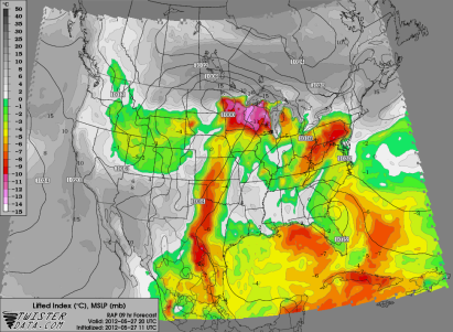
The hot temperatures along with the moisture in the area will be create a strongly unstable environment by the evening hours after peak daytime heating. CAPE values near 3,000 J/kg and a lifted index around –10 will provide more than enough “juice” and lift to produce isolated to widely scattered severe thunderstorms during the latter part of the day.
CAPE:
Lifted Index:
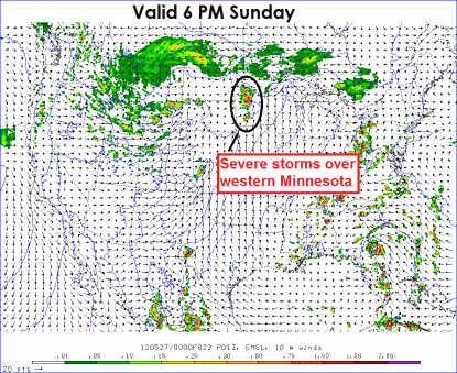
As far as timing of the storms today, the forecast models seems to be all over the place, but I am favoring the thunderstorm activity to move through the Twin Cities late tonight into the early overnight hours. Right now it appears storms will fire after 6 p.m. across western Minnesota, then slowly progress eastward towards the Twin Cities after nightfall. The Twin Cities will be impacted sometime between 11 p.m. and 1 a.m.
Stay safe today if you have any outdoor plans, especially late in the day, then keep it tuned to Stormchaserschwartz.com and StormChaser Schwartz social media outlets for additional information today!
RS


thank you for your updates! i live in Rice lake, wi and between you and SPC i keep an i on what could happen! thanks again!
ReplyDeletedave