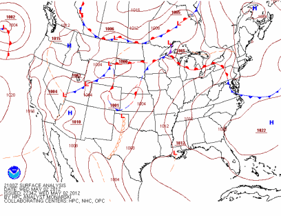
Another active thunderstorm day was upon us as a frontal boundary positioned itself across the central part of Minnesota on Wednesday, May 2nd. This would be the focal point for severe thunderstorms.
The Storm Prediction Center outlined southern Minnesota in an area of a slight risk for severe thunderstorms in their 7:35 AM (all times are CDT) outlook:
From the SPC forecast discussion:
SUFFICIENT WESTERLY FLOW ALOFT WILL PROMOTE SUPERCELL STORM STRUCTURES CAPABLE OF VERY LARGE HAIL...DAMAGING WINDS...AND A ISOLATED TORNADOES.
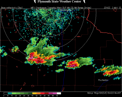
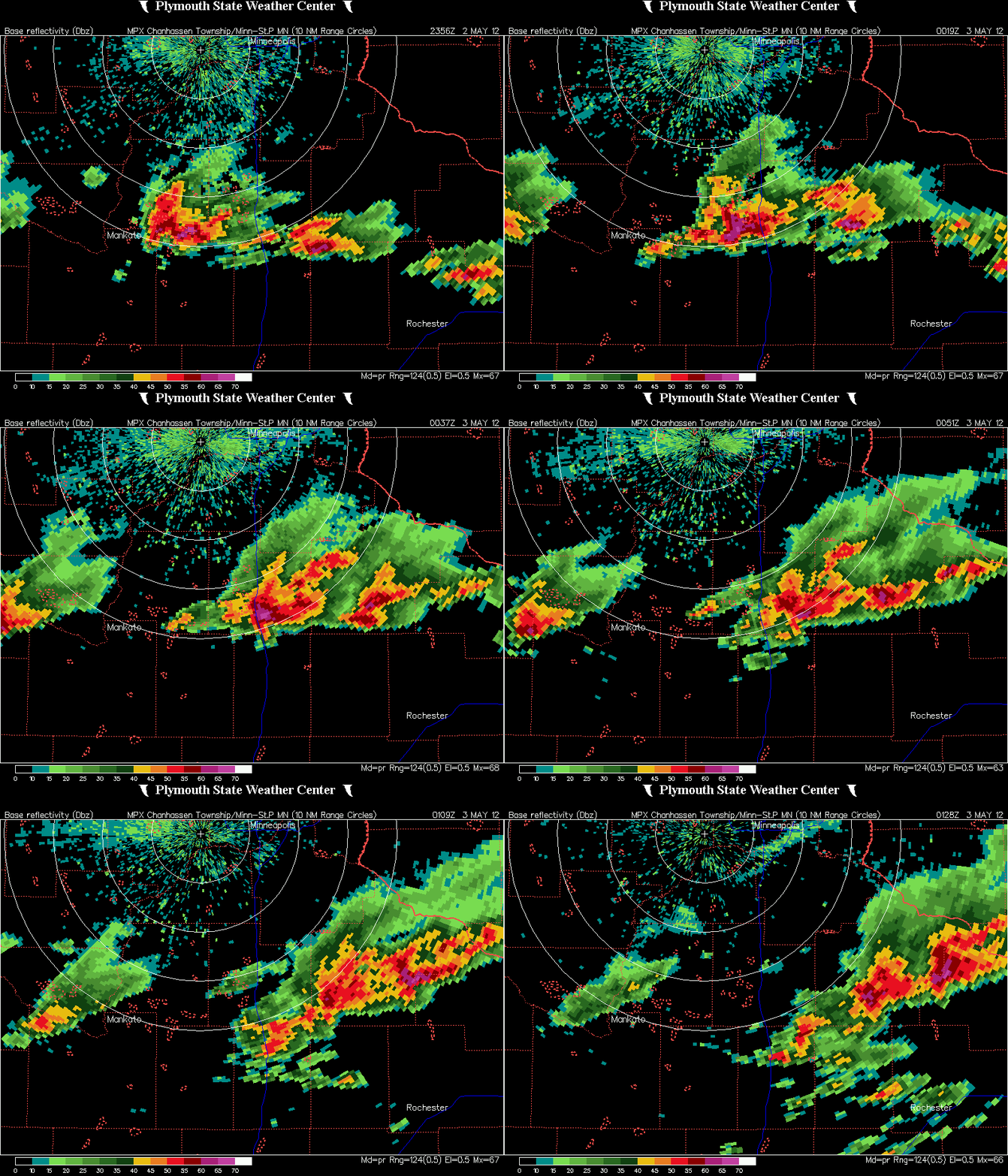
By the late afternoon, storms began to fire south of the Twin Cities area, affecting Mankato, and tracked eastward towards Interstate 35 around Faribault and Owatonna. This radar image below is from 6:42 PM CDT, which depicts a merger of two cells in the Mankato area. This was about the same time I made the decision to attempt and intercept of this cell near the interstate at Faribault.
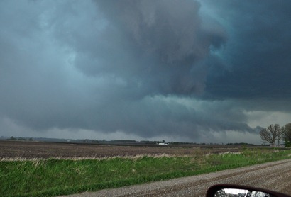
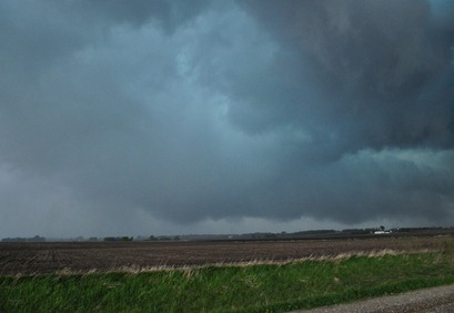
As I got to Faribault, I decided to head a bit further south towards the town of Medford to get into better position for seeing something interesting out of this cell. I traveled west of Medford on Steele County Road 12 and then north on Steele County Road 11/72, stopping to take some photos at 7:25 PM. I found myself on the outflow side of the storm as strong winds were rushing against the side of the car. I did not have my anemometer set up on the car rooftop, but I estimated the winds to be around 30 to 40 miles per hour at that time.
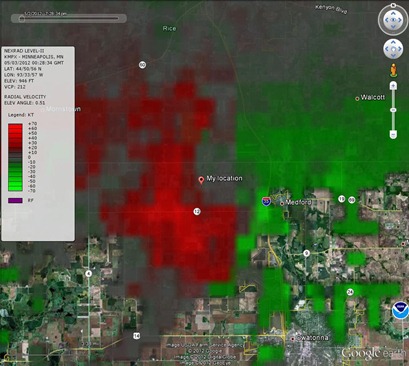
The cell appeared to begin to show a hook echo at 7:28 PM when this radar image was taken with my location noted. I found myself to be right in the belly of the beast. Normally, I like to be at least a mile out from the storm for safety reasons and to get a wider perspective of the storm structure, and usually I am pretty good about watching myself. Perhaps I was a bit gung-ho on my hopes of finally seeing a tornado. It was a little too close for my comfort level. Something that I will take from this chase was a learning experience on positioning. The center of circulation was also passing a couple hundred yards north of County Road 12, so I could have been driving right into a potential tornado had I not turned onto a side road before the circulation and I crossed paths. It was like some force was telling me to get out of the way of this monster.
At 7:28 PM, the greatest area of rotation was closer to Interstate 35. However, it was too close to Medford for my liking. NEVER do I want to see a populated area directly in the path of a potentially tornadic system. Being a storm chaser is a double-edged sword. Every chaser wants to see good storms, but a the same time, hoping they do not affect where people live.
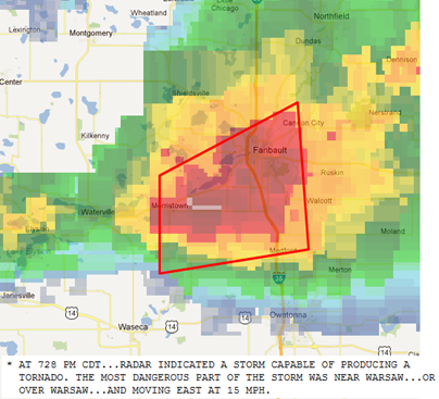
The cell went tornado warned at 7:32 PM. I found myself on the southern extent of the warning polygon heading back towards the freeway. No tornado was ever spotted in the warning area, which was a good thing considering the towns and cities that dot the interstate, as well as travelers on the freeway.
Here is a radar loop of the cell as it crossed Interstate 35 and headed towards southeastern Minnesota. Once the storm crossed the interstate to the east around 7:40 PM, I decided to call it a day. The supercell characteristics were quickly diminishing and it transformed into a heavy rain and large hail producer. I also had some items at home to take care of before the day was over, so I could not stay all night.
Here a chase summary of the mesocyclone near Medford:
No tornadoes were reported this day, but it dropped quite a bit of large hail along a 135 mile path across southern Minnesota:
This was a nice chase being able to cruise down I-35 to catch up with the storms pretty quickly without dealing with a lot of traffic or figuring out back roads to get to the storm.
Total reports: None
RS




No comments:
Post a Comment