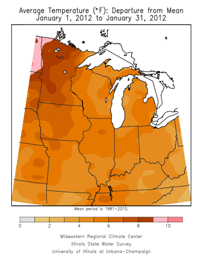
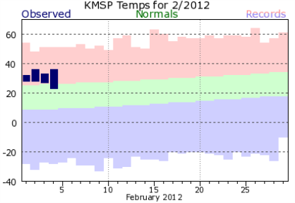
It appears the trend of above normal temperatures will come to end briefly by the end of this week. It may come as a shock since we have been spoiled by the ridiculously nice winter we’ve had so far this season. January was running some seven to ten degrees above normal across much of Minnesota, and finished as the eighth warmest in the Twin Cities since 1872. Minneapolis-St. Paul averaged 23.3 degrees for the month, or 7.7 degrees above normal. St. Cloud averaged 19.8 degrees, or 8.2 degrees above normal.
Across the Twin Cities, February has started off much the same way - mild.
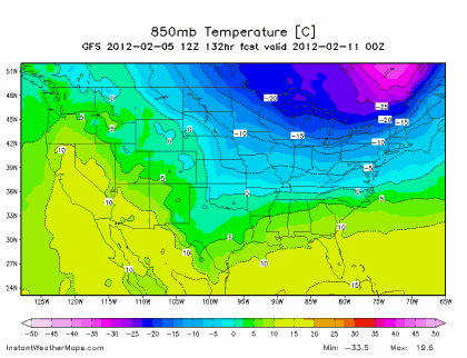
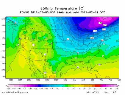
Both the GFS and European models depict a low centered over Hudson Bay in Canada driving Arctic air south into the Upper Midwest by the weekend. There is a pretty good likelihood that some parts of Minnesota, especially the Arrowhead Region, will see below zero readings at times between Friday and early Sunday.
GFS:
Euro:
This weather maker will NOT bring any snow along with it. In fact, I don’t really see any significant snow for at least a week. Winter sports lovers days may be numbered as average temperatures begin to climb as we head towards spring. By the end of February, the average high temperature is 33 degrees - just beyond freezing.
RS


No comments:
Post a Comment