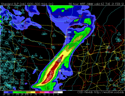
President’s Day will see a change in the weather pattern from spring-like to a wintery one. The culprit is a low pressure area that will track across the southern half of the state by the end of the day Tuesday.
A pocket of warmer air will be found Monday afternoon from Mankato to the Twin Cities, and down to the river bluffs of La Crosse, Wisconsin.
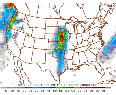
With this warm air in place, precipitation will start off as rain Monday night across southern Minnesota as temperatures hover at or just above freezing. Best chances to see rain early will be from the Twin Cities to Mankato starting at about 6 PM. Just in time for the end of the evening commute home for those that work this day.
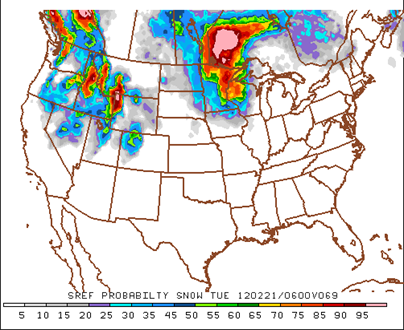
Best chances to see snow early will be across the Alexandria area:
By midnight Monday into Tuesday, it should be cold enough for snow across most of the state. Snow should fall across the Twin Cities by this time.
Here are a few weather model (NAM, GFS, and Euro) depictions of where the precipitation will fall. These maps are as of midnight Monday into Tuesday. The common theme among the models seems to be that the southeastern corner of Minnesota will have the best shot of seeing the most snow out of this system. Snow amounts around Rochester and points south and east of two to four inches is not out of the question.
NAM:
GFS:
European:
With the rain early in the Twin Cities, this will cut into our totals for snow. If the timing and storm track doesn’t vary too much, then I think the Twin Cities could be in line for one to two inches of snow.
The active weather pattern will continue through next week, and chances appear good right now of seeing another round of snow towards the end of the week. I’ll keep an eye on this one. Stay tuned!
RS


No comments:
Post a Comment