Earlier this week, it appeared the Twin Cities would take the brunt of a major winter storm with possible blizzard conditions. Over the last few days, the forecast models threw a curveball and shifted the heaviest snow across the northern sections of the state leaving the Twin Cities to about one inch of snow the latter half of Sunday into Monday morning. The heaviest snows will now fall across central and northern Minnesota. St. Cloud to Brainerd may see two to four inches of snow, while locations such as Duluth, Grand Folks, and International Falls may see four to seven inches of snow. Areas near Grand Marais could see eight inches or more of snow.
Temperatures will be approaching 40 degrees by Sunday night, so there is the possibility that some of the snowflakes in the Twin Cities could be mixing with rain.
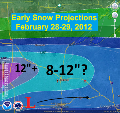
The southern part of the state may get in the action early next week as a more significant snow impacts the area Tuesday into early Wednesday. Despite the erratic behavior of the models, there has been consistency so far on a more southern track with this system. Some of the latest trends are that this system will have a lot of water in the upper atmosphere to work with, around an inch, to give it the capability of dropping a foot of snow to some locales.
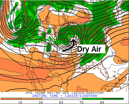
One of the concerns I have with this system over the last couple model runs is dry air attempting to work its way into the low pressure center. This could cut snow totals drastically, and will be something that has to be monitored over the next couple days. I don’t think this weather maker is a slam dunk in terms of large amounts of snow as others are making it sound.
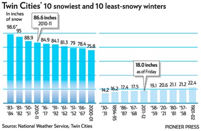
Officially in the Twin Cities, 18 inches of snow has been recorded for the season so far, or fifth least snowy of all time. It is possible we could be off the top ten least amount of snow list by the end of next week!
RS


No comments:
Post a Comment