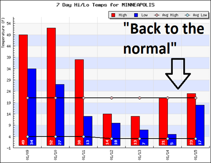
Reality set in last week as high temperatures plummeted from the 30s and 40s to begin the week, to finishing with more seasonal temperatures in the 20s. The average high this time of the year is 21 degrees. Welcome to January, this is how it’s supposed to feel!
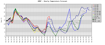
Temperatures will fluctuate quite a bit between now and the end of the month. Sunday will see highs into the 30s, before trending downward through Wednesday as a cold front moves sweeps across the state early Monday morning. We may see low temperatures close to zero by the middle of the week.
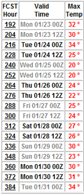
A warm-up is on tap to start next week with highs climbing into the 30s by Monday, the 23rd. January is closing out with above normal temperatures, according to the GFS model, as temperatures hover around the 30 degree mark.
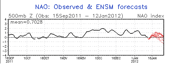
While the North Atlantic oscillation (NAO) is forecasted to trend negative during the remainder of January, it will not have a major impact on our weather. It will force temperatures towards normal in conjunction with La Niña. The NAO controls the strength and direction of westerly winds and storm tracks across the North Atlantic and affects weather patterns across the eastern half of the United States. A negative trend means the westerlies are suppressed, and the weather turns colder over the coming weeks. One of the theories why our winter has been so mild this year is due to the positive NAO from mid-November through January.

While we will see episodes of typical January weather when it comes to temperatures between now and the end of the month, we are not looking at extremes that we saw during the later half of 2010.
RS


No comments:
Post a Comment