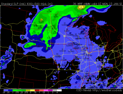
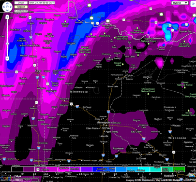
Friday’s snow came through during the first half of the day, and dropped generally one to two inches of snow across the Twin Cities. As expected, the heaviest amounts were seen along the Interstate 90 corridor in southern Minnesota, where as much as five inches of snow fell. The snow ended a bit sooner than I thought, so that kept actuals down from my projections, but were still within the ranges assigned Friday for the most part. Figuring precise totals will never be an exact science.
Snow totals by location (inches of snow, city, county):
- 5.0, GRAND MEADOW, MOWER
- 5.0, JACKSON, JACKSON
- 5.0, WORTHINGTON, NOBLES
- 4.6, ALBERT LEA, FREEBORN
- 4.5, COMFREY, BROWN
- 4.5, PRESTON, FILLMORE
- 4.5, LUVERNE, ROCK
- 4.2, FAIRMONT, MARTIN
- 4.0, LANESBORO, FILLMORE
- 4.0, LA CRESCENT DAM, WINONA
- 4.0, WINDOM, COTTONWOOD
- 4.0, IVANHOE, LINCOLN
- 3.8, MADELIA, WATONWAN
- 3.6, SPRING VALLEY 3E, FILLMORE
- 3.0, VESTA, REDWOOD
- 3.0, NEW ULM, BROWN
- 3.0, MANKATO, BLUE EARTH
- 3.0, SPRINGFIELD, BROWN
- 3.0, WINNEBAGO, FARIBAULT
- 3.0, WSW ST JAMES, WATONWAN
- 3.0, LAKE CITY, WABASHA
- 2.9, 1 ENE MINNESOTA LAKE, FARIBAULT
- 2.8, NE FAIRMONT, MARTIN
- 2.7, MONTICELLO, WRIGHT
- 2.0, 1 NNW SPRINGFIELD, BROWN
- 2.0, MARSHALL, LYON
- 1.9, 1 ESE MILROY, REDWOOD
- 1.8, ANDOVER, ANOKA
- 1.8, THEILMAN, WABASHA
- 1.7, NORTH MANKATO, NICOLLET
- 1.7, ELGIN, OLMSTED
- 1.5, WINTHROP, SIBLEY
- 1.5, MINNESOTA CITY, WINONA
- 1.4, ST PAUL, RAMSEY
- 1.3, PLYMOUTH, HENNEPIN
- 1.2, MADISON, LAC QUI PARLE
- 1.1, MINNEAPOLIS, HENNEPIN
- 1.1, WABASHA, WABASHA
- 1.0, GLENWOOD, POPE
- 1.0, ORONO, HENNEPIN
- 1.0, GOLDEN VALLEY, HENNEPIN
- 1.0, CHANHASSEN, CARVER
- 1.0, MENOMONIE, DUNN
- 1.0, ST LOUIS PARK, HENNEPIN
- 1.0, NORTH ST PAUL, RAMSEY
- 1.0, BROOKLYN CENTER, HENNEPIN
- 1.0, WACONIA, CARVER
- 1.0, WINONA, WINONA
- 0.5, ST CLOUD, STEARNS
The forecast models have mellowed out the weather makers for next week in terms of snow, at least for the Twin Cities. We may see an inch or two on Sunday and then again Wednesday, but no major winter storms are in the foreseeable future before we warm back up to normal towards the end of the month.
Sunday’s weather will be impacted by a one, two punch of a couple low pressure areas that will exit the area by Monday.

January looks like it will end on a whimper as far as snow goes. Soon, we will look at the February outlook and see if we end up receiving payback for the quiet winter so far.
RS


No comments:
Post a Comment