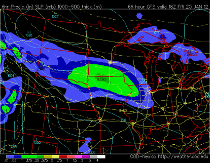
The first significant snow of the year may arrive on Friday as a Pacific weather system pushes into the area. The models have fluctuated a bit with intensity and location of this system in the last 24-36 hours, but it will be something to keep a close on. If this weather maker does come to fruition, then I believe at least four inches of snow will be possible across portions of southern Minnesota.
All models seem to be agreement of a south central location target for snowfall. The GFS favors a broader portion of the target area, while the NAM and Euro models favor the heaviest of the snow across southeastern Minnesota location. Snow lovers will rejoice in seeing an old friend, Old Man Winter.
GFS:
NAM:
Euro:
This will be the first of several snow chances looking into next week. A snow-covered ground looks likely at some point over the next seven days. Warmer temps are expected through the end of the month, which will work at the snow cover and probably leave us with bare ground by the time February rolls around.
February already? Time sure flies fast!
RS


No comments:
Post a Comment