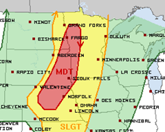
I’ve been watching Memorial Day for the last several days to understand what kind of severe weather outbreak we may have across the Midwest. My analysis of the most active weather today is an agreement with the Storm Prediction Center. The moderate risk area in red across eastern South Dakota into far western Minnesota will be the hot zone today for all modes of weather – tornadoes, large hail, and damage winds. This weather is an association with a cold front that will be moving in from the Dakotas through Minnesota during the overnight hours on Tuesday.
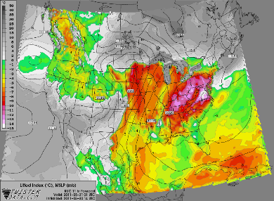
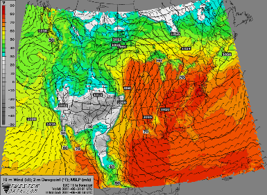
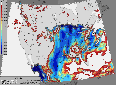
Looking at the four major severe weather parameters from Twister Data – instability, shear, lift, and moisture, it appears everything is in place for an active day. There is one key area which is keeping this day from being a potentially explosive outbreak that I will touch on later.
Instability – check. CAPE values are very high signaling extreme instability in the atmosphere over the eastern Dakotas and Minnesota.
Shear – check. The strongest levels of shear will be found over Nebraska, however, the entire area will be conducive for tornado development by this evening.
Lift – check. The cold front will surface as the lifting mechanism for storms to fire across Nebraska and up through northeastern South Dakota
Moisture – check. Out ahead of the cold front and south of a northward lifting warm front, dewpoints will scream well into the 60s with some 70-degree readings possible.
So what’s the one major variable that’s holding this back from being a huge outbreak? It’s the cap – warm air aloft. This is one of the stronger caps I’ve seen all year so far. It’s expected to hold throughout much of the day, but appears it will weaken enough for storms to develop across Nebraska, South Dakota, and far western Minnesota. This cap will keep the storms from tracking far quickly and some of the models show the storms weakening as they move across Minnesota during the late night hours towards the Twin Cities. With the strength of the cap, I can buy into this, and it’s been a trend with the models during the last couple days.
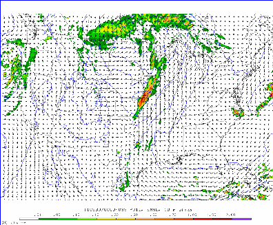
Here are a couple models “futurecasing” the precipitation later today.
The HRRR places storm initiation across central Nebraska this evening. Supercells are forecasted to develop during this time period.
As we move into the late night, the supercells are expected to transition into a squall line as they march through Minnesota. By 10 PM, the line is approaching the Alexandria and Willmar areas.
The high resolution WRF model shows more of a line of storms forming generally in the same area as the HRRR.
During the overnight hours, the line of storms dissipates as it marches towards the Twin Cities metro as it as trouble working against the cap in place. We may see a few stronger storms out of this, but not expecting widespread severe weather during this time frame.
So this is what I’m forecasting today. For people across the western portion of the state, you’ll want to pay attention to the skies closely and move indoors quickly if it turns threatening. Have a great Memorial Day!
RS






No comments:
Post a Comment