Severe weather chances will return for Sunday as a strong area of low pressure moves from the Dakotas across Minnesota. The upper-level winds out ahead of this system are very strong, which will cause quite a bit of turning in the atmosphere. Enough for supercells with the possibility of tornadoes.
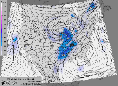
Here is a look at the difference in wind direction from the surface up to approximately 18,000 feet. Notice that winds as you head towards Wisconsin are nearly 90 degrees, which is ideal for rotation within the supercells.
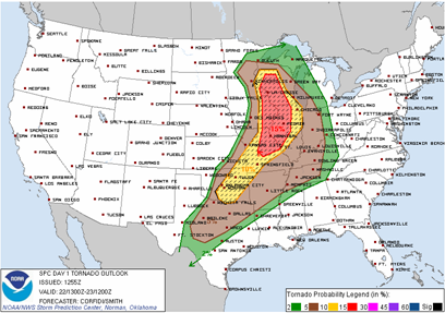
Here is the Storm Prediction Center outlook for the tornado risk today. There is a high potential for tornadoes across much of the Midwest. For Minnesota, the greatest tornado threat will lay over the southeastern Minnesota, roughly east of a Rochester north-south line. However, much of state has at least an isolated chance of a tornado.
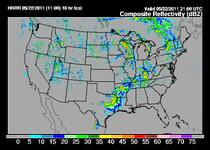
Looking ahead for later today around 4 PM using my two favorite “futurecasting” sources for determining where storms may develop, there seems to be a bit of disagreement. The first model places storm development near Rochester and the other initiates storms north of the Twin Cities. I’m tending to favor the first model because it’s in closer to the proximity of the upper-level winds and also frontal boundaries. Concerned with the Rochester area today and points southeastward for having a rough day.

RS


No comments:
Post a Comment