It was another unusual day for tornadoes. Didn't feel real conducive for severe weather with the morning convection and clouds lingering around. A strong low pressure system was forecasted to track from the Dakotas across the Twin Cities metro area into Wisconsin. I illustrated the position of the low pressure center, valid at 2:43 PM Sunday.
I was local this day as I was visiting my parents in Eden Prairie. A linear segment with embeded individual cells were moving into the southwest side of the metro by 1 PM, which prompted the first metro warning of the day for severe thunderstorms at 12:53 PM.
Things didn’t really start to get interesting until 2 PM, when I was tracking an area of rotation on the velocity radar scan (watching winds towards and away from the radar site in Chanhassen) approaching the Eden Prairie area. Did some “porch” chasing after 2 PM as I watched the rotation pass about a half mile to the east along near Highway 169 in Eden Prairie. There were just a bunch of low based clouds, but nothing real interesting at that point. Here is radar imagery put together by the National Weather Service in Chanhassen beginning at 2 PM:
The National Weather Service also released an image of the areas of stronger rotation as the storms tracked through the metro:
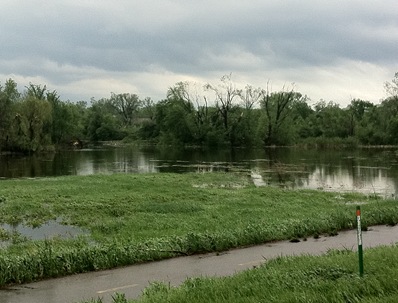
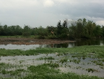
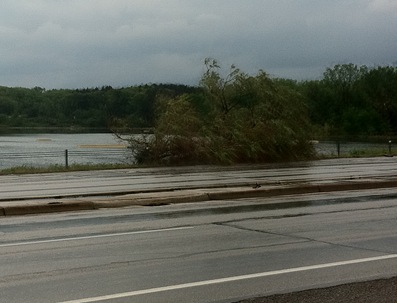
Heard a tornado warning issued at 2:10 PM as the storms tracked north and decided to go after them since it appeared business was about to pick up. Chased with nothing more than a cell phone with radar and ham radio due to the unexpected nature of the severe weather setup. Pretty much was playing catch-up with the storm from the beginning, so I ending up being more of a damage spotter than storm chaser this day. In the car, I was flipping between WCCO and MPR on the car radio to hear of any damage reports. Heard reports coming in of activity/damage in the St. Louis Park area, so I took Highway 100 up towards the St. Louis Park/Minneapolis area where I began to see debris in the road at Highway 100 and Interstate 394. There were pieces of brown insulation that I later learned were from the Nestle plant nearby. From Highway 100, I took the Highway 55 east exit and about 1.25 miles down the road is where I saw what appeared to be the tornado path as trees were snapped at Theo Wirth Park near the Golden Valley/Minneapolis border. I stopped the car along Highway 55 to check out the damage and also reported to the NWS that something went through here, so they would be aware of it for when they did their survey. Took these photos at 2:53 PM from Highway 55 in Wirth Park on my cell phone and lack zoom, so I apologize for the quality. They won't win any awards. I was standing in what I thought was the tornado path track. This was my first chase ever where I’ve seen damage first-hand from an apparent tornado.
Large trees snapped in the distance:
Downed tree limbs blocking the Highway 55 shoulder and twisted street signs near Wirth Lake:
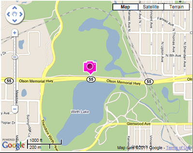
Since I used my phone, I was able to geotag the photos and this is where they were taken. Based on the damage pattern with fallen trees in different directions, it looked possible that a tornado went across Wirth Lake and the park.
The National Weather Service performed a damage survey and by Tuesday had concluded that an EF-1 tornado tracked from St. Louis Park to Blaine, including the Wirth Park area.
This tornado was one in a family of small tornadoes that touched down this day around the Twin Cities metro. Had we received more sunshine and daytime heating, I feel that this situation could have been A LOT worse! It will take some time for Minneapolis to recover, but it just goes to show you how even an EF-1 tornado can wreck havoc on a metropolis!
Total reports: 1
“12 TO 18 INCH TREE LIMBS DOWN IN THEO. WIRTH
PARK...SPOTTER SAYS POSIBLE TORNADO”
RS


Good written article...Storm Repairs minneapolis
ReplyDeleteThe accounts I've heard from chasers are that urban chases are hard do to traffic and road construction. So you almost have to be at the right place at the right time anyway
ReplyDelete