Showing posts with label heat wave. Show all posts

Saturday, July 7, 2012

Summary of recent heat wave and capping inversions explained

The heat wave concluded Friday night as a cold frontal boundary pushed from north to south across the southern half of Minnesota, and triggered a few rain showers and thunderstorms.  The hot weather went out with a bang as the high temperature in the Twin Cities reached 102 degrees.  It was also the first time since 1988 that one month has seen at least two days with temperatures at 100 degrees or above.

The stretch of eight days from June 29 to July 6 with high temperatures at 90 degrees or above has happened on five other occasions in the Twin Cities.  The average high temperature during this period was 96.4 degrees, and the average temperature was 84.5 degrees.  This would make it the 4th warmest heat wave ever based on mean temperature!

Date

High Temp

Record Temp

Year

6/29/12 90 102 1931
6/30/12 92 100 1931
7/1/12 94 100 1883
7/2/12 99* 96 1911
7/3/12 97 100 1949
1990
7/4/12

101*

100 1949
7/5/12 96 100 1982
7/6/12 102 104 1936
* = Indicates new record

The sagging frontal boundary was very visible on radar Friday night.  Thunderstorms developed along the leading edge on this boundary, but had a hard time surviving.

MPX_N0R_1207062357_912x684_none__0865_an

Why did the storms die off so quickly?  There was a capping inversion in the atmosphere.  What that means is there was a layer of warm (stable) air stacked on top of a colder layer.  Cloud formation from the lower layer is "capped" by the inversion layer.  Convection requires warm air rising into cold air.

Shown below is a temperature profile at the National Weather Service in Chanhassen at 7 pm Friday.  While temperatures (red line) initially decrease with height from the surface, temperatures increased with height from 925 millibars (~2500 feet above sea level) to 850 millibars (~4600 feet above sea level).  The limited how much storms could grow, even when there is plenty of energy for them to work with.

12070700

Dr. Greg Forbes from The Weather Channel briefly explains in the video clip below how the cap prevents thunderstorms from happening:

RS

Friday, July 6, 2012

Heat wave summary in the Twin Cities

The-heat-index-is-somewhere-between-OMG-and-WTF
Since June 29th, the high temperature in the Twin Cities has been at 90 degrees or above.  Combined with high dew point values, the heat index has reached in excess of 100 degrees for several periods during the heat wave.  New high temperature records were set on July 2 and July 4, as the mercury climbed to 99 and 101, respectively.  The daily high temperature reached 100 degrees or more for the 34th time since 1873 over the Fourth of July.
 

Date

High Temp

Record Temp

Year

6/29/12 90 102 1931
6/30/12 92 100 1931
7/1/12 94 100 1883
7/2/12 99* 96 1911
7/3/12 97 100 1949
1990
7/4/12

101*

100 1949
7/5/12 96 100 1982
* = Indicates new record
 
July 4th also marked the first time since 1995 an hourly observation at MSP Airport recorded a temperature of 100 degrees or more with a dew point of 70 or greater.  That statistic was impressive to me.  We do not often hit 100 degrees here, and to do with tropical humidity like this is quite an accomplishment.  A heat index of 109 was observed from my home in Shakopee at 7:15 pm Thursday.
 
548322_10150915253752544_1372633222_n
 
RS

Tuesday, July 3, 2012

Just how rare is this heat in the Twin Cities?

The high temperature barely missed hitting the century mark in the Twin Cities on Monday as the mercury peaked at 99 degrees.  However, this did break the previous record of 96 degrees set over a century ago in 1911.

Just how often do we see these hot temperatures in the Twin Cities?  In the past 30 years, the temperature reached 100 degrees or more only 10 times.  That is once every three years on average.  The most recent 100 degree or higher reading was last year on June 7, when the temperature hit 103 degrees.  In most cases to top triple digits, a lower dew point, below the mid-60s, is needed for air to mix down to the surface efficiency.  Not often do you see temperatures greater than 100 when the dew point is at 70 degrees or more.  Here is a look at a few case studies:

On June 7, 2011, temperatures climbed as the dew point decreased.  Temperatures reached the 100 degree mark when the dew point dropped into the high 50s.  A humidity level in the “comfortable” range for most people.

060711_temp_dp

The opposite was found to be true on July 31, 2006.  On this day, the maximum temperature of 101 was obtained as the dew point was rising steadily.  At 4 pm, the dew point was 68 degrees as the temperature peaked.  Would the temperature have hit 100 if the dew point was at 70?  Close call, but probably not.  98 or 99 degrees would have been more likely in that instance.

073106_temp_dp

Jumping back over 10 years from 2006 to 1995 was the next occurrence of temperatures 100 degrees or greater.  July 13 was the date as temperatures soared to 101 degrees yet again.  This was one of the few times where the temperature hit 100 degrees as the dew point was over 70 degrees.  When this happened at the 4 pm hour, the dew point observation was 71.  The heat index was 109.

071395_temp_dp

Monday’s 99 degrees was reached as the dew point was 67 degrees at the 6 pm hour.

RS

Monday, July 2, 2012

Hot, with severe thunderstorms possible over the Northland

A warm front, or is this instance, a “hot” front will move to the International border by this evening.  This front will be the focus for thunderstorms, some of which will be severe across the north.  To the south of the front, very warm air will dominate the state today.

94fwbgus_070212

The greatest area of concern for severe thunderstorms is north of a St. Cloud line, but the focus for storm development will be near the warm and cold front intersection.

NAM_221_2012070200_F21_EHI_3000_M

The Storm Prediction Center has indicated hail as the greatest threat today, with the purple area below as the area at risk.

hailthreat_070212

Unlike yesterday’s setup, a tornado threat does exist today as an area of low pressure moves into the northwest portion of the state.  Areas northwest from Bemidji may see an isolated risk of a tornado during the early stages of severe weather.

NAM_221_2012070200_F24_EHI_1000_M

The high-resolution WRF model at 7 pm below depicts a bow echo moving through the Northland tonight, with a secondary bowing mesoscale convective system forming near Fargo and moving southeastward.  The Fargo bow misses the Twin Cities to the north.

rflslp24_070212

Further south, it is just going to be hot.  Dew points in the 70s will keep temperatures from reaching 100, but highs around 95 degrees should be doable today in the Twin Cities.  The mid 90s will dominate most of southern Minnesota.

MNtemps_070212

A heat advisory is in effect for the southern half of Minnesota today until 10 pm as heat indices will top 100 by the afternoon.

heatadv_070212

Stay cool today!

RS

Sunday, October 9, 2011

The streak

The Twin Cities have been on a run of 80-plus degree weather for the last several days.  This has been the longest streak of 80 degree days in the Twin Cities in October since 1953.

Here are the high temperatures throughout the streak.  The 88 degree reading on October 5th set a record for the day, breaking the previous record of 87 degrees set in 1879.  85 degrees on October 7th tied a record for the day.

Date

High temp (°F)

10/2/11 80
10/3/11 83
10/4/11 85
10/5/11 88
10/6/11 83
10/7/11 85
10/8/11 83
10/9/11 83?

I think we’ll see at least one more 80 degree day Sunday as highs top off at around 83 degrees.  If we do reach at least 80 degrees, we will tie the 1953 stretch of consecutive 80-plus degree days with 8.  With clouds moving in for Monday, it appears that the streak will be in jeopardy as temperatures peak into the upper 70s, which by no means is cool for this time of the year.  By next weekend, highs will only reach the 50s in the Twin Cities and 40s outstate - a return to normal temperatures that is projected to last for at least the remainder of the month.

RS

Tuesday, July 19, 2011

Unbelievable heat!

Some of the most tropical air the state has ever seen is ongoing this week. Heat indices well over 110°F has been common place across a good chunk of the area. It's not been so much the temperature as it has been the humidity. At the 3 PM hour on Tuesday, July 19, 2011, a new dew point record was established at Minneapolis-St. Paul International Airport with a reading of 82°F! This breaks the old dew point record set back on July 30, 1999 of 81°F. This kind of humidity is very rare around here. Our dew point is typically 75°F or less. The heat indices should subside by Thursday.

Using my professional-calibrated handheld Kestrel weather unit, I went outside my home shortly after 7 PM, and took a heat index reading of nearly 118°F! Yes, even at that time of the day, it was still quite warm, thanks to a dew point reading around 81°F.

IMG_0642

Tomorrow won't have 120°F heat indices, but you'll still want to exercise caution outdoors. Use some common sense and live for another day. Heat is nothing to mess with.

RS

Sunday, July 17, 2011

Near record dew point today in MSP?

Looking at some of the projected dew point temperatures for Sunday, Minneapolis-St. Paul will be very close to hitting the all-time record of 81-degrees on July 30, 1999.  The short-term forecast model, the Rapid Update Cycle (RUC), has done a good job at projecting temperatures and dew points, and will use it's projections.  Earlier this morning, it was indicating an unbearable dew point value of 81-degrees just around sunset.

bufkitoverview

Looking at the latest data, the RUC has now indicates a dew point around 83-degrees around 10 PM!  The Global Forecast System (GFS) also hints at 80-plus degree dew points, but it’s generally not reliable in the short-term, and I don’t put much stock in it within 24 hours of an event.

dewpoints

Based on the 9 AM temperature and dew point observations around the Twin Cities, it is quite possible that there will be areas that see dew points in the low 80s later on today.  At MSP airport, the temperature is already 85-degrees, with a dew point at a very sticky 77-degrees!

CITY           SKY/WX    TMP DP
TWIN CITIES    MOSUNNY   85  77
ST PAUL        SUNNY     84  79
CRYSTAL        MOSUNNY   85  78
BLAINE         SUNNY     82  79
EDEN PRAIRIE   SUNNY     85  79
LAKEVILLE      SUNNY     82  77
SOUTH ST PAUL  SUNNY     84  77
LAKE ELMO      PTSUNNY   82  79

With the higher dew points, I’m going to knock my temperature forecast down a degree and go with a high temperature of 97-degrees for Sunday.  Heat indices will be in excess of 105-degrees for most of the day, so you’ll want to find a cool place quickly.  This type of weather leads to heat exhaustion quickly, and I don’t recommend ANY physical outdoor activity today.  Stay indoors.

RS

Saturday, July 16, 2011

That’s hot!

A tremendous amount of heat will be arriving into Minnesota within 24 hours, and will last for several days.  Temperatures will be well into the 90s through Wednesday of next week with high humidity.  Dew points will above 70-degrees, making it feel quick sticky out there.  This combination will lead to dangerous heat index values above 100-degrees.  As a result, the National Weather Service in Chanhassen has issued an Excessive Heat Warning for the Minnesota counties and a few Wisconsin counties the office serves until 9 PM Wednesday.  Additional Wisconsin counties are expected to be added by this afternoon.

Capture

... Excessive heat warning remains in effect until 9 PM CDT
Wednesday...

An excessive heat warning remains in effect until 9 PM CDT
Wednesday.

* Temperature... afternoon highs in the lower to middle 90s with low temperatures in the middle to upper 70s

* heat index... 105 to 110 degrees in the afternoon and early
evening.

* Impacts... these hot and humid conditions will lead to a
heightened risk of heat related stress and illnesses.

Precautionary/preparedness actions...

Take extra precautions if you work or spend time outside. When possible... reschedule strenuous activities to early morning or evening. Know the signs and symptoms of heat exhaustion and heat
stroke. Wear light weight and loose fitting clothing when
possible and drink plenty of water.

To reduce risk during outdoor work... the occupational safety and health administration recommends scheduling frequent rest breaks
in shaded or air conditioned environments. Anyone overcome by heat should be moved to a cool and shaded location. Heat stroke is an emergency... call 9 1 1.

An excessive heat warning means that a prolonged period of
dangerously hot temperatures will occur. The combination of hot temperatures and high humidity will combine to create a dangerous situation in which heat illnesses are likely. Drink plenty of fluids... stay in an air-conditioned room... stay out of the sun...and check up on relatives and neighbors.

Looking at the overnight NAM models, here is the temperature map for Sunday showing the bulk of hot air surging northward.  Click the image below to enlarge.  Temperatures will be very close to 100-degrees for southern Minnesota.  For the Twin Cities, my thinking is that the high temperature will top off at around 98-degrees.  This will be dependent on the amount of cloud cover in the area, which can be difficult to predict days in advance.

NAM_221_2011071512_F57_TMPF_2_M_ABOVE_GROUND

Monday is looking quite steamy as well with another day of temperatures in the upper 90s.  Click the image below to enlarge.

NAM_221_2011071512_F81_TMPF_2_M_ABOVE_GROUND

The National Weather Service Hydrometeorological Prediction Center heat index forecast indicates heat index values hitting 110-degrees in Minneapolis-St. Paul (MSP) on Monday.

bchi_day3

Interpreting forecast data, the Hydrometeorological Prediction Center believes MSP has a 62% chance of seeing heat index values in excess of 105-degrees during the day on Monday.

hiprob105_day3

Make sure to drink plenty of water and your A/C is tuned and ready to go with the heat index likely in excess of 105-degrees!

RS

Wednesday, June 8, 2011

More record heat across Minnesota and Wisconsin

This illustration below pretty much sums up the June 7, 2011 heat well!

11June07_highs

Another day of record high temperatures across Minnesota and Wisconsin on Tuesday as the mercury climbed to 100-degrees or greater in many locations, which I thought was a good possibility heading into Tuesday.  According to the National Weather Service in Chanhassen, MSP airport had a high temperature of 103-degrees at 3:26 PM, setting a new record for June 7.  In addition, many other milestones were reached on Tuesday in Minneapolis-St. Paul:

    • Breaks the previous June 7th record of 95° set in 2004.

    • Was the first 100°+ reading since July 31, 2006 (101°).

    • Was the first 103°+ reading in almost 23 years, since July 31, 1988.

    • Was tied for the second warmest temperature in the past 69 years (July 31, 1988 with 105° was the only warmer one)

    • Was the second earliest on record that 103° had occurred, only behind May 31, 1934.

    • Fell 1° short of the all-time June record of 104° set on June 27th, 1934.

According to Dr. Mark Seeley at the Minnesota State Climatology Office, the Minneapolis-St. Paul record temperature was a new all-time statewide record for this date, breaking the previous record of 100-degrees at Madison and Lamberton in 1987.  New high temperature records were also set in St. Cloud, MN at 101-degrees, and Eau Claire, WI at an even 100-degrees.  Locally, close to my home, Flying Cloud Airport in Eden Prairie topped out at 101-degrees.

This is a sharp contrast to the air across northern Minnesota where Duluth only saw a “cool” high of 71-degrees.  Here are some other high temperature readings across northern Minnesota.  if you’re familiar with the geography of northern Minnesota, you can see where the warm front lie during the day.  90-degree temperatures or greater are highlighted in orange, and locations with temperatures lower than 75-degrees are noted in blue.  Pretty sharp contrasts!

DULUTH AIRPORT : 71
INTERNATIONAL FALLS : 69
BRAINERD : 98
GRAND MARAIS MN : 68
HIBBING ARPT : 77
SKY HARBOR : 55
TWO HARBORS : 68
SILVER BAY : 70
GRAND MARAIS : 70
ELY : 79
CRANE LAKE : 72
EVELETH : 79
BIGFORK : 81
GRAND RAPIDS : 81
LONGVILLE : 88
PINE RIVER : 95
AITKIN : 90
MOOSE LAKE : 84
HINCKLEY ARPT : 97
CLOQUET : 70
MCGREGOR : 86

prog00hr

A cold front is forecasted to move through the state into Wisconsin during the overnight hours Wednesday morning, and bring an end to the record heat with it.  Since the atmosphere is capped, we will not see anything in terms of precipitation locally with the heat and cool clash of air masses.  We’ll finish out the week with high temperatures dipping into the mid to upper 60s across a good portion of the state.  A much welcome change for sure.  Comfortable weather for me is 75-degrees and sunny – a sense of balance rather than going from one extreme to the other.  Enjoy a pleasant end to the week!

RS

Tuesday, June 7, 2011

The heat is on!

The big news story lately is the incredible hot air mass over much of the United States as the jet stream has lifted into the southern parts of Canada from the southwest, depicted below.

RUC_255_2011060704_F00_WSPD_250_MB

This allowed the heat “bubble” to travel north and spread through the Midwest, with high temperatures well into the 90s on Monday, and even some sporadic 100-degree temperature readings.

curtemps_600x405

Closer to home, here were some high temperatures from airports across Minnesota and western Wisconsin. MSP airport set a new record for June 6, 2011 with a temperature of 97 degrees. The previous record was 95 degrees set in 1987 and 1979. Areas in southern and southwest Minnesota saw highs climb to 99-degrees! If you wanted to find cooler air around the southern parts of state, you would have to look east into Ladysmith or Rice Lake, Wisconsin, where the mercury was a mere 87 degrees for the day.

hightemps

:                       MAX   MIN 
:ID         LOCATION    TEMP  TEMP
EAU : EAU CLAIRE WI   : 94 /  58 
MSP : MINNEAPOLIS MN  : 97 /  70 
STC : ST CLOUD MN     : 94 /  60 
AXN : ALEXANDRIA MN   : 91 /  61 
MIC : CRYSTAL MN      : 95 /  67 
FCM : FLYING CLOUD MN : 96 /  68 
RWF : REDWOOD FALLS MN: 98 /  66 
STP : ST PAUL MN      : 94 /  65
AEL : ALBERT LEA MN   : 99 /  72
AQP : APPLETON MN     : 95 /  61
BBB : BENSON MN       : 91 /  59
ANE : BLAINE MN       : 91 /  68 
CFE : BUFFALO MN      : 92 /  65 
CBG : CAMBRIDGE MN    : 91 /  66 
CNB : CANBY MN        : 96 /  61 
FRM : FAIRMONT MN     : 99 /  70 
FBL : FARIBAULT MN    : 91 /  70 
GYL : GLENCOE MN      : 96 /  65
GHW : GLENWOOD MN     : 91 /  61 
GDB : GRANITE FALLS MN: 99 /  63 
HCD : HUTCHINSON MN   : 95 /  67 
21D : LAKE ELMO MN    : 91 /  64 
LVN : LAKEVILLE MN    : 93 /  64 
LJF : LITCHFIELD MN   : 91 /  64 
LXL : LITTLE FALLS MN : 90 /  59 
14Y : LONG PRAIRIE    : 90 /  61 
DXX : MADISON MN      : 95 /  61 
MKT : MANKATO MN      : 99 /  72 
MGG : MAPLE LAKE MN   : 92 /  64 
MVE : MONTEVIDEO MN   : 99 /  63 
JMR : MORA MN         : 86 /  55 
MOX : MORRIS MN       : 93 /  61 
ULM : NEW ULM MN      : 97 /  66
OVL : OLIVIA MN       : 95 /  68 
OWA : OWATONNA MN     : 95 /  70 
PEX : PAYNESVILLE MN  : 92 /  61 
PNM : PRINCETON MN    : 91 /  72 
RGK : RED WING MN     : 93 /  66 
ROS : RUSH CITY       : 89 /  58 
D39 : SAUK CENTRE MN  : 93 /  61 
SAZ : STAPLES MN      : 88 /  59 
JYG : ST JAMES MN     : 99 /  70 
SGS : SOUTH ST PAUL MN: 94 /  67 
ACQ : WASECA MN       : 97 /  64
BDH : WILLMAR MN      : 93 /  64 
RPD : RICE LAKE WI    : 87 /  56
LUM : MENOMONIE WI    : 90 /  61 
OEO : OSCEOLA WI      : 91 /  64 
RNH : NEW RICHMOND WI : 90 /  64 
RCX : LADYSMITH WI    : 87 /  58 

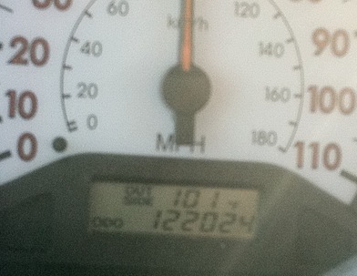
While heating home from work, I had an unofficial temperature reading on my car thermometer of 101-degrees(!) in Eden Prairie just after 6 PM (the official high was 96-degrees at Flying Cloud Airport at 5 PM).  I happened to grab a picture of this rare event:

IMG_0509

The forecast models are indicating that Tuesday will be warmer than Monday’s steamy air mass.  Based on the temperatures we saw Monday, it wouldn't surprise me if we saw many locations across the state around the century mark for highs.  Combine that with the humidity, and we’re looking at a heat index well over 100-degrees!

untitled

heatindex

As a result of this early taste of summer heat, along with the humidity, that National Weather Service in Chanhassen has issued the following warnings and advisories:

Heat Advisory valid at Jun 07, 12:00 PM CDT for Anoka, Carver, Dakota, Freeborn, Goodhue, Le Sueur, Rice, Scott, Steele, Waseca, Washington [MN] and Dunn, Eau Claire, Pepin, Pierce, St. Croix [WI] till Jun 07, 8:00 PM CDT

Excessive Heat Warning valid at Jun 06, 3:00 PM CDT for Hennepin, Ramsey [MN] till Jun 08, 7:00 AM CDT


OVERNIGHT LOWS WILL ONLY FALL IN THE MID 70S... FOLLOWED BY HIGHS IN THE MIDDLE 90S TUESDAY AFTERNOON. HEAT INDEX VALUES ON TUESDAY WILL CLIMB TO AROUND 100 DEGREES.

You'll want to make sure to have plenty of water as it’s very easy to suffer from dehydration on days like this, even if you aren’t moving around much.  Any perspiration is less water in your body.  Also, spending time in an air conditioned space, lake, or swimming pool will also keep you cool.  Elderly folks should be checked on, and ensured that their air conditioning units are working.  By Wednesday, we will see a noticeable drop in temperatures/humidity and a return to more seasonable spring weather.  Until then, stay cool and safe!

RS

Wednesday, January 26, 2011

Heat wave!

The bitter cold stretch that has plagued most of Minnesota for the last couple months is about to come to a brief end as warmer air is being driven up from the south.

The forecast map below, courtesy of Twister Data, shows temperatures approaching the freezing point Saturday around the noon hour.

heatwave

This is a welcome relief for many people that have felt down about this winter.  Personally, this has to be the worst winter in terms of brutality to the human spirit since the 1995-96 winter season, where we had a stretch of six consecutive nights of -20°F or colder.  As for myself, I’m going through a pretty bad case of seasonal affective disorder.  It’s been difficult to find the energy and motivation to live a normal lifestyle.  Winter activities just haven’t been real pleasant to participate in this year without feeling like you’re being pushed indoors.  This winter just sucks, I don’t know what else I can say about it.  Fortunately it appears the worst of the winter is over with and it’s just a matter of getting through March, the snowiest month of them all.  Usually, I can make it to March before I’m ready for spring, but this year my tolerance level has been cut much shorter.  When spring rolls around, I will not be taking it for granted!

RS