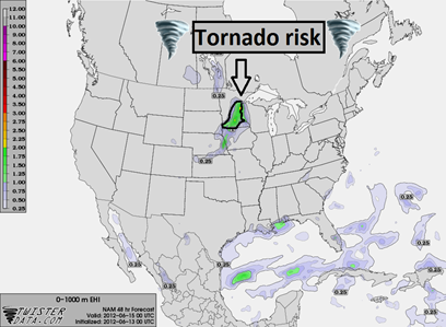
Warm and humid air will work it's way into Minnesota by Thursday, which will create an unstable air mass for thunderstorm development as a cold front moves through the area during the evening hours.
Isolated severe thunderstorms will be possible in the warm sector (behind the warm front and ahead of the cold front) across the southern two-thirds of Minnesota Thursday night.
The veering of winds is much more impressive with this system than the Sunday storm. The upper, lower, and surface level winds are forecasted to be from the southwest, west, and southwest, respectively.
250 mb:
500 mb:
850 mb:
The wind shear profile seems to be favorable for tornadoes, and surface-based convection is likely. I wouldn’t be surprised to see a tornado watch issued during the afternoon hours on Thursday.
You will want to keep an eye to the sky if you have Thursday outdoor activities, as this storm will mean business if we get the necessary daytime heating.
RS


No comments:
Post a Comment