A cold front is expected to sweep through Minnesota during the day Sunday, which will bring a good chance of thunderstorms, some severe, to the region.
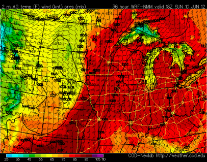
Cold front position at 7 pm Sunday:
Out ahead of the front, conditions will be hot and muggy on Sunday. Temperatures are forecasted to be in the mid-90s with dew points approaching 70 degrees.
Temps:
Dew point:
This will result in a very unstable atmosphere for thunderstorm development. There will be more than enough energy for storm initiation once the cold front begins to move into the state.
The greatest risk for severe weather will be over the central and northern sections of Minnesota. Roughly from the St. Cloud area, and northward. However, an isolated severe storm is possible for the Twin Cities metro.
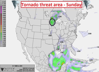
The overall primary concerns from the Sunday storms are large hail and damaging winds. A tornado risk does exist closer to the intersection of the cold and warm fronts in northern Minnesota – Brainerd lakes vicinity and north.
If you are going to be out on the lake during the latter half of the weekend, make sure to have a NOAA Weather Radio with you, and keep an eye on the western horizon for darkening skies!
RS


No comments:
Post a Comment