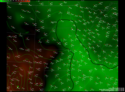
A line of strong to severe thunderstorms moved through west central and east central areas of Minnesota Sunday night causing high winds, flooding, and numerous funnel cloud reports. The line weakened as it approached the Twin Cities as drier, more stable worked into the system from convection earlier in the day.
Dew points were most impressive across northeastern South Dakota and far west central Minnesota at 7:30 pm Sunday. Despite the models printing a large MCS (mesoscale convective system) coming into the Twin Cities by 10 pm or so, I knew it was going to lose a bit of punch, and questioned whether it would be severe by the time it arrived into MSP. I think weather folks tend to get too excited about what the computers are telling them and assume the worst without looking at other information. One can not forget the basics, such as surface observations. Have to ask yourself, “Does this model solution make sense?”
Only one official tornado report was received Sunday east of Wheaton, Minnesota. There were many reports of funnel clouds and thunderstorm wind damage across west central Minnesota. The highest wind gust observed was 77 mph in the town of Cosmos at 9:56 pm.
The National Weather Service offices were busy issuing warnings all night. Tornado warnings clipped the far west metro, and severe thunderstorm warnings extended all the way to the St. Croix River. The Twin Cities saw heavy rains, two to three inches, on already saturated ground, triggering flash flood warnings.
It was definitely a busy night, and we could see more storms on Tuesday. Look for additional updates as they are warranted!
RS


No comments:
Post a Comment