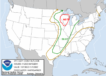
Another day, another chance of severe thunderstorms across the area. A moderate risk of thunderstorms is in play today for the eastern Twin Cities metro east into most of Wisconsin, with a slight risk of severe weather for the central part of the country. I’m expecting a pretty rough day for our friends on the other side of the St. Croix River, with large hail and perhaps strong tornadoes.
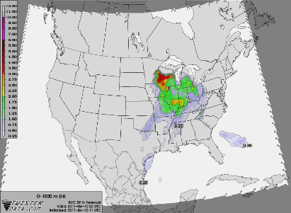
Strong instability. CAPE values, which I described a little bit about yesterday, will be around 2000-3000 J/kg across the moderate risk area, which is quite strong for this time of the year. Another parameter I use in forecasting is the Energy Helicity Index (EHI). It combines instability and wind shear to come up with a value where tornado development will be the greatest. Almost like a tornado probability scale if you will. It appears the area just east of the St. Croix will be prime for supercells near the warm front. The maps below from Twister Data are from 3 PM today, showing the most favorable environment for storm initiation:

Expecting another very active day for our area and you’ll want to pay attention to watches and warnings issued as storms may fire and move very quickly today. Stay safe!
RS


No comments:
Post a Comment