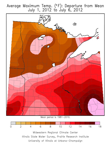
July started out of the gates at a record pace with very mild temperatures - well above the norm for this time of the year. During the first six days of the month, high temperatures have been 12 to 15 degrees above normal across the southeastern part of Minnesota. The Twin Cities has already seen two 100-degree plus days this month, which has not happened in 24 years.
As of July 9th, the average high temperature in the Twin Cities is a sweltering 94.7 degrees. The typical maximum temperature is around 83 degrees.
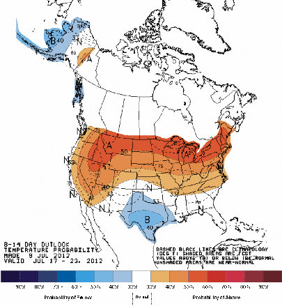
The Climate Prediction Center seems to think the hot trend will continue throughout July. It is forecasting above normal temperatures over the next 14 days for the northern two-thirds of Minnesota.
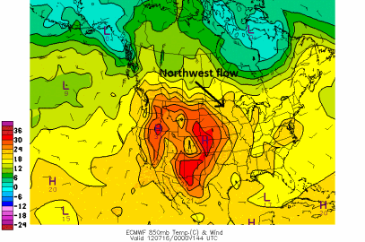
What is responsible for this mild, dry weather pattern? A dome of high pressure is located out in the Rockies. Northwest winds in the upper levels of the atmosphere will draw in the warmth across the state.
Right now, it appears that Wednesday and Thursday have a chance of seeing 90 degree temperatures in the Twin Cities. Seeing a 90 in for a high temperature this weekend would not be out of the question either.
The heat will stick around into next week as temperatures remain well above average. There is a pretty good chance that July 2012 will go down in the books as the warmest July on record. The warmest July on record is 81.4 degrees in 1936.
RS


No comments:
Post a Comment