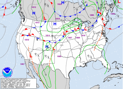
A meandering frontal boundary across southern Minnesota will be the focus for thunderstorm activity on Friday.
Strong to severe thunderstorms will be possible across central into southwestern Minnesota near a low pressure center. A capping inversion is forecasted to break by the afternoon to allow storms to develop.
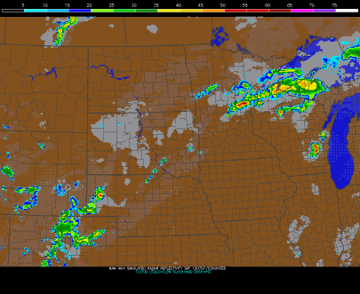
The high-resolution WRF model places heavy (severe?) thunderstorms across southwest Minnesota by 7 pm. MSP is represented by the red dot. Any thunderstorms that do develop across southern Minnesota will affect the Twin Cities after midnight, and will likely be a marginal severe weather threat.
Another one of the models paints the heaviest of the weather to the north, near the Lake Mille Lacs area. So there is some disagreement within the models are where the storms will form today, therefore a broad area from east central into southwestern Minnesota will be highlighted for the threat of severe thunderstorms.
The main threats from any severe thunderstorms will be large hail and damaging winds. Another factor will the heavy rains. Between now and 6 am Saturday, one to two inches of rain is possible across the Northland. This is an area that does not need anymore rain. Duluth is still drying out from flooding, and water levels on the lakes and rivers that run through Aitkin County are high.
There is still a bit of uncertainty with today’s severe weather setup, but it is always a good idea to have a means of receiving weather alerts ready to go.
RS


No comments:
Post a Comment