The month of July will go down as hot and very muggy. The Twin Cities experienced a record three consecutive day period of dew points of 80-degrees or higher. On July 19, a record maximum dew point in the Twin Cities was established of 82 degrees at 3 PM. The dew point actually reached a higher mark at 84-degrees, however, this was in-between hourly observations, and therefore not recorded. At MSP, from count, high temperature were at or above average for 26 of the 31 days in the month
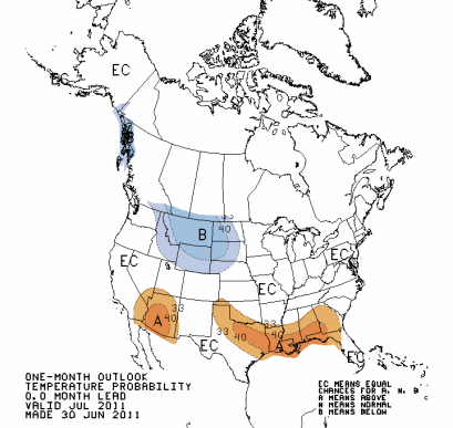
Temperatures were above normal as was predicted by the Climate Prediction Center in their June outlook. At Minneapolis, the average temperature during the month was 78.8°F, normal temperature of 73.2°F for a departure of 5.6-degrees above normal. At St. Cloud, the numbers were still above average. The average temperature for the month was 75.1°F, with a normal average temperature of 69.8°F for a departure of 5.3-degrees above normal.
This July had the fifth warmest average temperatures on record, according to the National Weather Service:

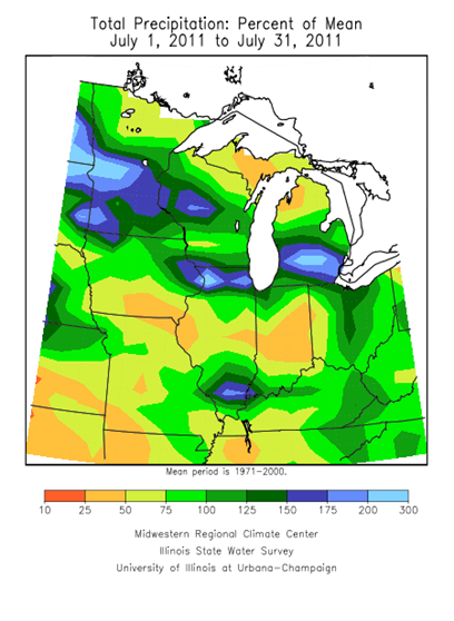
With the heat, saw plenty of rain during the month due to storm systems repeatedly moving throughout the area. Many places in the state were at or above normal for precipitation. At Minneapolis, 5.23-inches of rain fell, with an average of 4.04-inches for the month that equates to 1.19-inches of rain above normal. St. Cloud was even wetter with 5.63-inches of rain, compared to an average of 3.34-inches of rain for 2.29-inches above normal. These rainfall amounts are consistent with the Climate Prediction Center June outlook.
Looking ahead to August, temperatures will be more seasonal for late summer. Cooler air stays to the west, while the south continues to scorch in the heat.
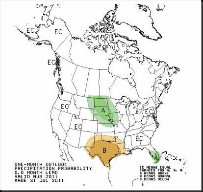
Our rain that stuck around will linger into August. Chances for above normal precipitation exists for the southwestern two-thirds of Minnesota.
Enjoy the dog days of summer! It’s sad to think that summer is almost over after the warmth arrived late this year.
RS


Ryan: Great job with your Blog I read it often and enjoy it. About the August outlook, all guidance that I can find shows the upper level ridge moving north over parts of Idaho most of Wyoming and Montana and Parts of the Dakotas around the middle of week three with us staying in a more zonal flow to nw flow. By the middle of the week starting on the 19th the GFS flattens the ridge keeping us below normal but the ECMWF moves the Ridge towards us, if the ECMWF is right we could see high's in the +4-6 area about the time the state fair starts, but that would still be at or around 85°. All in all I think that below normal area will end up being over the Upper Mississippi Valley, we will see what happens but right now it looks like we have seen our last 90°+ temps. You will notice the difference in you energy bill this month compared to last LOL
ReplyDeleteThank you Randy for the compliments! Glad to know that someone gets something out of these posts. Your forecast is very thorough and hope we see some 80's yet this year. If I ever start a forecasting business, you're at the top of the list! Just glad the A/C is done working hard this year, so I don't have to take another mortgage to pay for it! LOL
ReplyDelete