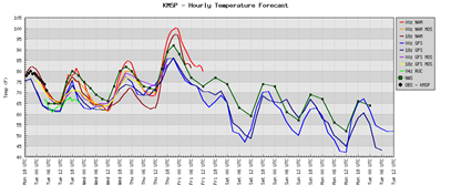
As August comes to a conclusion, summer weather is going to stick around a little longer across much of Minnesota, at least through this week. We’ll see the warmest temperatures this week on Thursday. Here is the temperature map as of 7 PM Thursday showing the warm air streaming northward:
The latest short-term NAM forecast model guidance indicates high temperatures on Thursday will be well into the 90-degree range and close to the century mark. For this late in the year, it’s quite an amazing feat to have temperatures this warm!
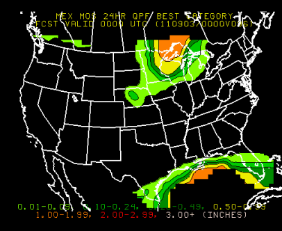
Along with the heat, humidity will return to the area later in the week. This will provide a better chance of thunderstorms as a cold front cuts through the state. With strong instability and wind shear in place, some severe weather will be possible later in the day on Thursday and into the overnight hours if the atmospheric cap can break. Rain amounts will be heavier traveling north where up to an inch of rain may fall across the arrowhead region of Minnesota.

RS


No comments:
Post a Comment