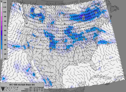
Thunderstorms will be found Saturday along a frontal boundary that stretches across central sections of Minnesota.
While instability will be modest, there will be enough wind shear (40 to 50 knots) to generate supercells that may eventually evolve into a complex of strong to severe thunderstorms.
A couple of the high resolution forecast models are in agreement of showing thunderstorm activity later this evening across central Minnesota. Here is how the models are depicting storms at 7 PM today:
It appears the greatest threat for severe weather will be from the St. Cloud to Brainerd area today. This activity will push through the state by early Sunday morning, and bringing with it a pleasant day.
Anyone heading up to the cabin later today should keep these forecasts in mind. Being caught on the lake is the last place you want to be during a thunderstorm.
RS


No comments:
Post a Comment