The latest NAM forecast guidance is in and it appears the trend for a southerly storm track continues from run to run. This will bring heavy snow to the Twin Cities metro.
Here is a depiction of the low pressure track through the southern half of Iowa:
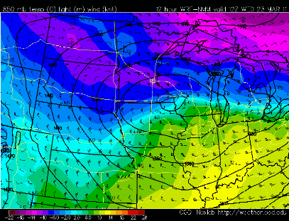
The low pressure center will bring cold air in behind it across much of Minnesota to set the stage for significant snow:
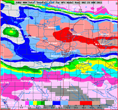
Just how much snow? The NAM is bringing the heaviest snow totals across the northern half of the metro, but the entire metro may see enough snow to plow. Based on the trend throughout Tuesday for higher snow totals, I’m now projecting the Twin CIties to see anywhere from 6 to 12 inches of snow. There will be a wide range of snow amounts with this system as the dividing line for heaviest snow bands will setup over or near the Twin Cities.
Update on warnings for the area. The National Weather Service expanded the Winter Storm Warnings southward to now include Hennepin and Ramsey Counties through Wednesday. Flood watches still remain over the southern half of the state where river flooding is expected to occur very soon. Many areas along rivers will be at or near flood stage right now. Yesterday and today’s rain accelerated water rises.
More to come!
RS


No comments:
Post a Comment