Well, I hope you have been able to get outside and enjoy the sun and 50-degree temperatures as of late. It has definitely brought a smile to my face as winter didn’t want to loosen it’s grip this season. Get out while it lasts, because our weather appears to be transitioning to a wetter pattern over the next week. Sunday through Wednesday, we will be dealing with rain, then a storm system moves in from Nebraska, drawing enough cold air for more of the s-word, snow. Yes, Mother Nature isn’t quite done with winter yet, despite astronomical spring beginning Sunday evening.
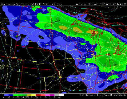
Forecast map showing where the precip bands lie Wednesday morning. The heaviest of the snows, we’re not talking much to begin with, stay north of the I-94 corridor:
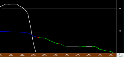
So just how much? The rain that falls before Wednesday will generally be on the light side with amounts less than a half inch. As the rain transitions to snow on Wednesday, there may be a brief period of freezing rain. The GFS is hinting at the snow to arrive before noon on Wednesday, in which we could expect a couple inches. The forecast models become a little more unreliable with the seasonal transitions, so I don’t have a a lot of confidence in the totals or the start and stop times.
This will have an impact on the flooding situation, and unfortunately the bulk of the precipitation may fall in the Red River basin, which doesn’t need any more rain or snow. The next few weeks will be a challenge attempting to keep flood waters out as sandbagging efforts start and road closures become more numerous. I’m attempting to keep this in perspective with what the people of Japan are going through. This is more of a minor inconvenience for what we have to deal with.
Stay tuned for more updates.
RS


No comments:
Post a Comment