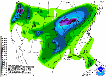
A strong low pressure area is forecast to track across Minnesota this weekend, bringing with it a very good chance of any decent precipitation in almost two months.
Many parts of the state could see upwards of an inch of much-needed rain or more from this powerful storm system. This will no doubt decrease the degree of drought that plagues much of the state.
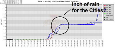
Taking a closer look at the Twin Cities, some of the models are spitting out about an inch of rain.
Severe threat?
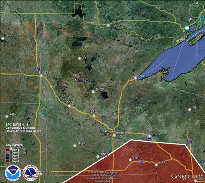
Over the last couple days, the Storm Prediction Center has highlighted southeastern Minnesota in their daily outlooks for the possibility of severe weather on Saturday.
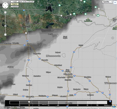
I’m not quite buying into this scenario, at least for Minnesota. By Saturday morning, it appears we will dealing with cloud cover which will inhibit convective activity later in the day. Both the European and American GFS model illustrate this.
Euro:
GFS:
Temperatures are going to struggle to get into the 60s I believe, which will diminish any substantial severe weather threat. Dew points may get into the 60s, but the lack of any daytime heating will make moisture content irrelevant. Instead, much of state will be dealing with quality, soaking rains.
RS


No comments:
Post a Comment