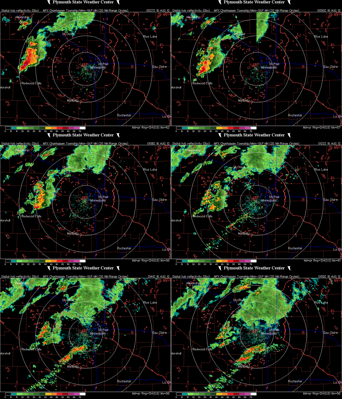
Thunderstorms developed across far western Minnesota during the late afternoon and pushed eastward. As night came, the air began to stabilize a bit, and the storm complex started to lose signs of life. During the initial hours, severe weather did occur and large hail fell.
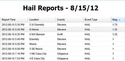
Here is a listing of hail reports meeting severe criteria received by the National Weather Service from Wednesday night. Golf ball size hail occurred near Donnelly in Stevens County. Half-dollar size hail was seen near the cities of Morris and Benson.
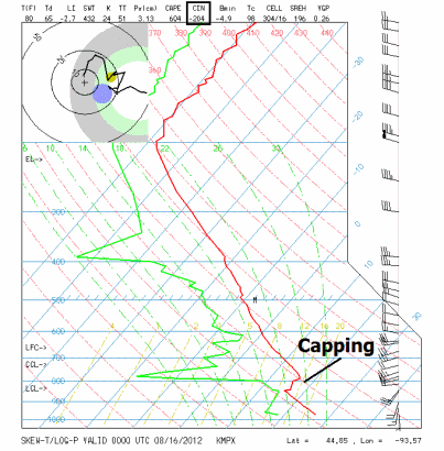
Another reason the storms fell apart as they approached the Twin Cities was that conditions were not favorable for severe thunderstorms. The 7 pm observations from Chanhassen indicates the atmosphere was capped. In addition, CAPE values (an indicator of instability) were low, indicating a minimal chance for severe thunderstorms.
This has been the story all year long. It seems as if one ingredient has always been missing for severe weather, leading to many busts. It makes me almost believe that “It’s 2012, storms just don’t get real bad here”.
RS


Amazing how the two lines threaded the needle to mostly miss Shakopee.
ReplyDeleteRyan the inversion did have a great deal to with the storms drying up. But at the surface the 7pm sounding was showing a great deal of surface cape. I believe the temp inversion and the resulting dry layer at about 2km worked together to produce a Mix Layered CINH of -142, it's no wonder we couldn't get any lift.
ReplyDeletehttp://www.spc.noaa.gov/exper/soundings/12081600_OBS/
Thanks for the additional analysis, Randy, very interesting!
Delete