After a long stretch of quiet weather throughout July and first half of August, the threat for severe thunderstorms returns to the area today as a strong cold front will be moving through Minnesota during the evening hours.
Temperatures are expected to be near 90 degrees across southern Minnesota, with dew points approaching 60 degrees will create just enough instability for convective activity later on today.
Damaging winds are the greatest threat from any of the thunderstorms today as storms are expected to be linear in nature along the cold front pushing eastward. Winds will have the potential to reach 55 to 60 mph.
The Storm Prediction Center highlights this below:
THE GREATEST SEVERE POTENTIAL HOWEVER -- LIKELY IN THE FORM OF DAMAGING WINDS ASSOCIATED WITH A WELL-ORGANIZED LINE AND POSSIBLY SOME BOWING STRUCTURES -- IS EXPECTED ACROSS A PORTION OF THE ERN DAKOTAS BUT PARTICULARLY MN...FROM FROM MID AFTERNOON THROUGH EARLY EVENING. SOME THREAT MAY CONTINUE EWD INTO WRN PORTIONS OF THE UPPER GREAT LAKES REGION LATER IN THE EVENING...BUT DIURNAL COOLING/STABILIZATION SUGGEST LESSER POTENTIAL THAN EARLIER/FARTHER W.
Timing. Storms are expected to develop during the early evening hours in western Minnesota from near Bemidji to Alexandria. This is where the greatest concentration of energy for initiation will be located.
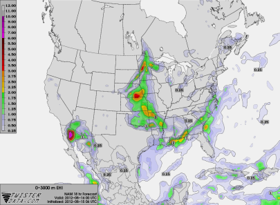
The line should be into the Twin Cities around 9 to 10 pm, but intensity should diminish once the sun sets and we lose daytime heating, allowing attrition to come into play. Storms this time of the year are very dependent on heating. Here is one of the high-resolution models at 9 pm tonight (click the image to enlarge):
I believe the threat for damaging winds will be the greatest west of an International Falls, Grand Rapids, St. Cloud, and Worthington line. The Twin Cities may see a few strong/severe storms storms depending on when the line begins to lose some of it’s punch. It will be something to monitor later today.
RS


No comments:
Post a Comment