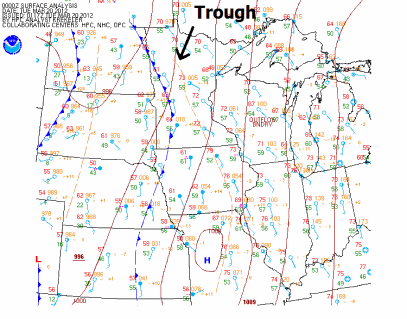
Our final day of astronomical winter ended with a round of strong to severe thunderstorms across southern Minnesota. These storms developed along a trough of low pressure in a slightly unstable environment with temperatures in the mid to upper 70s, and dew points near 60 degrees. Here is the surface map from 7 PM Monday.
Going into the day, clouds and limited instability appeared to hamper any widespread severe weather outbreak across much of the state. Satellite imagery from 11:45 AM Monday.
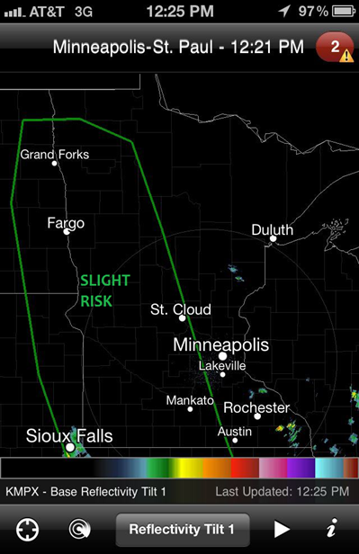
By the noon hour, the Storm Prediction Center determined that enough instability was in place for isolated severe storms ahead of an advancing cold front along the Minnesota/Dakotas border to include western Minnesota in a slight risk for severe thunderstorms.
...MO/IA NWD TO THE ERN DAKOTAS/WRN MN THROUGH TONIGHT... BOUNDARY LAYER DEWPOINTS IN THE MID-UPPER 50S BENEATH STEEP MIDLEVEL LAPSE RATES WILL SUPPORT A CORRIDOR OF WEAK-MODERATE INSTABILITY IN ADVANCE OF THE COMPOSITE OUTFLOW BOUNDARY IN MO/IA...AND THE SURFACE FRONT ACROSS THE ERN DAKOTAS. SOMEWHAT UNIDIRECTIONAL PROFILES WILL SUPPORT A RISK FOR ISOLATED DAMAGING WINDS/HAIL WITH A BROKEN BAND OF STORMS ALONG/AHEAD OF THE FRONT THIS AFTERNOON/EVENING ACROSS THE ERN DAKOTAS/WRN MN. STORM COVERAGE IS MORE CERTAIN FARTHER S INTO MO/IA WHERE CONVECTION IS EXPECTED TO INTENSIFY THIS AFTERNOON ALONG THE COMPOSITE OUTFLOW BOUNDARY NOW MOVING INTO WRN MO/IA. SOMEWHAT STRONGER LOW-LEVEL SHEAR /COMPARED TO FARTHER N/ WILL PROMOTE A RISK FOR EMBEDDED ROTATING STORMS IN A PREDOMINATELY LINEAR CONVECTIVE MODE...WITH AN ATTENDANT RISK FOR DAMAGING WINDS/ISOLATED TORNADOES.
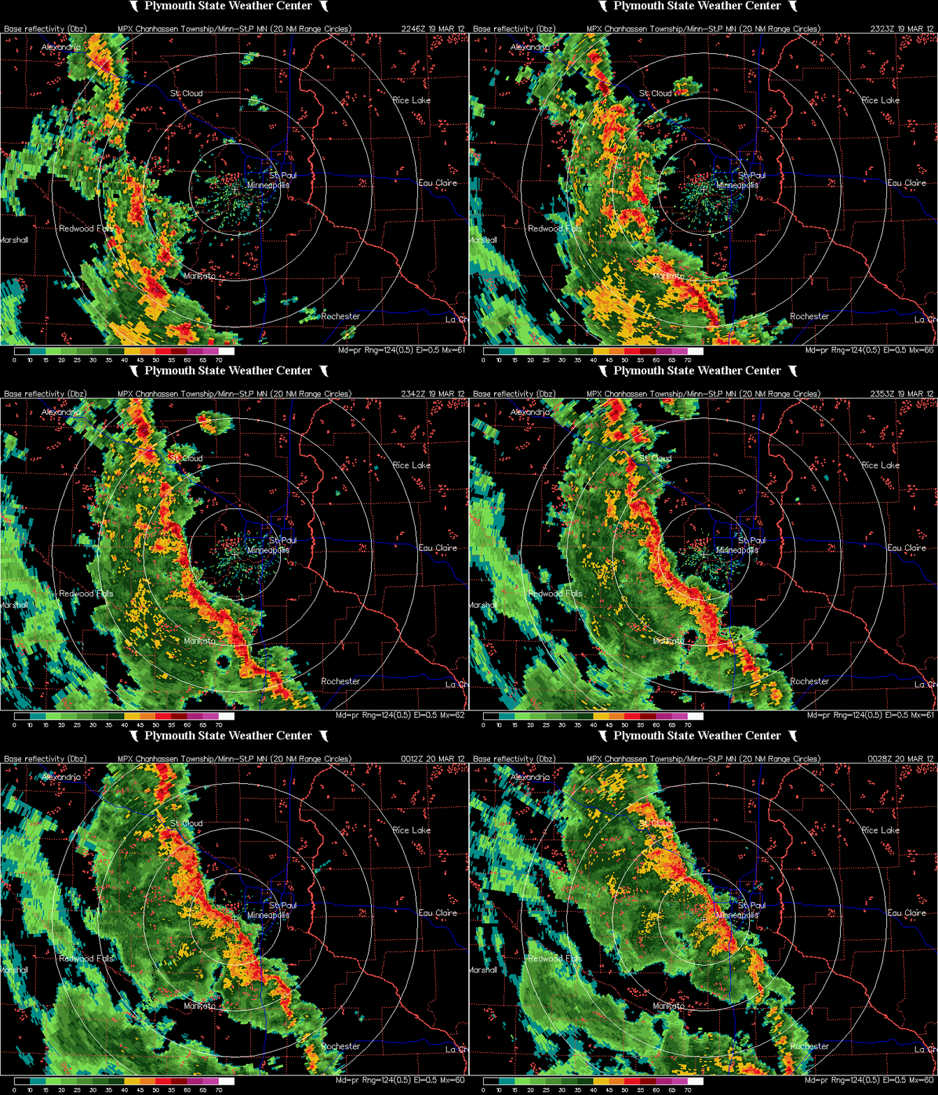
During the early evening hours, a line of storms developed and moved northward out of Iowa towards the Twin Cities. On radar, the line showed signs of bowing out in Freeborn and Le Sueur Counties, indicating strong winds. Radar loop of the storm approaching the Twin Cities is below.
All I saw while rushing out the door to catch this storm in Shakopee was winds to 35 miles per hour, and torrential rainfall that brought traffic to a crawl as drains tried to keep up with all the water. Cloud to ground lightning was also evident as the leading edge approached. The heaviest damage based on storm reports came from the town of Elysian in Le Sueur County. There was an unconfirmed report of a tornado by the public as numerous roofs were ripped off between Lake Elysian and Lake Francis. The National Weather Service in the Twin Cities may be doing a survey as early as Tuesday to determine whether the damage occurred from straight-line winds or a tornado. The earliest verified tornado in Minnesota occurred on March 18, 1968, north of Truman, MN (Martin County).
Additional damage happened further south. Here is storm damage to a grain silo from the Albert Lea area shared by Rusty Dawkins, Chief Meteorologist for KAAL-TV in Austin, MN, on Twitter:
Here are storm report highlights of wind damage and thunderstorm warnings issued during the duration of the storm:
Many locations across the state saw upwards to an inch of rain, with a few isolated places seeing close to two inches. Here is a radar estimate of total rainfall from Monday:
Overall, it was a pretty mild-mannered thunderstorm event with isolated severe storm damage across the south central part of Minnesota. The Storm Prediction Center had some difficulty figuring out this storm system with uncertainty in variables, but in the end I feel they made the right call by not issuing any severe thunderstorm watches as the storms posed a marginal severe threat for much of the evening. A watch in under these conditions would have created a lot of public hysteria for so early in the year. This event definitely had more bark than bite.
RS


No comments:
Post a Comment