The record high temperature in the Twin Cities will be flirted with today as temperatures are expected to climb close to 60 degrees behind a warm front moving through the area. The record for March 10th at MSP is 59 degrees set back in 1878.
The mild air as eliminated the snow pack from the southern Twin Cities metro all the way to the Minnesota/Iowa border. The snow pack is visible on satellite, as well as the larger lakes frozen over in northern Minnesota. The exposed ground combined with unusually warm air and low relative humidity has triggered a fire danger across the southern third of Minnesota.
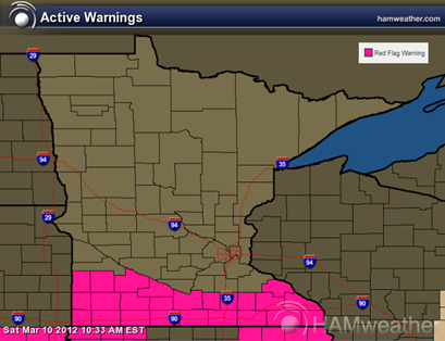
The result is a Red Flag Warning issued by the National Weather Service for the southern tier of counties in Minnesota effective until 6:00 PM today. This includes Redwood Falls, Mankato, and Rochester. It's quite rare to see a Red Flag Warning this early in the year. Typically these are issued before the green-up in April.
If you are working with an open flame today (including cigarettes), be extra cautious of your surroundings. It’s not going to take much to get a grass fire going.
RS


No comments:
Post a Comment