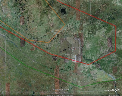
There is a slight risk of severe weather across much of southern Minnesota today, primarily during the afternoon and evening hours. The trigger for rough thunderstorms is a warm front draped across the central part of the state. The main weather threat from any storms today will be the potential for damaging winds as highlighted by The Storm Prediction Center for areas inside the red line. There is also concern about isolated tornadoes with initial storms that development across west central Minnesota from about St. Cloud to Alexandria and points northwest (orange area on the map) before the storm system evolves into a complex during the evening hours in a southeast direction towards the Twin Cities. For those that have outdoor plans later on today, you will definitely want to keep an eye to the sky.
RS


No comments:
Post a Comment