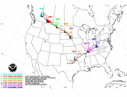
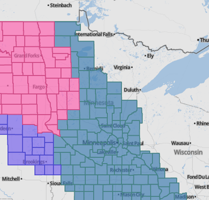
An Alberta clipper system will be the next weather maker across the five-state area heading into tonight, and lasting through Tuesday afternoon. Two episodes of snow is expected. The first wave will begin tonight lasting through the afternoon hours on Monday. This snow will blanket most of the southern two-thirds of Minnesota. The second wave will primarily effect the Twin Cities area, and locations to the southeast along the Mississippi River on the backside of the low pressure area as it exits the region.
Winter storm watches and winter storm warnings are already in place in anticipation of the snows. The watch and warnings are in effect through Tuesday.
Over the last week, weather forecast models are distinct differences as to the location of the low pressure area, which created uncertain with location and amounts. The American models painted the bulk of the snow over central and east-central Minnesota, while the non-American models kept the snow to the southwest. As the snow event approached, the non-American models shifted in agreement with the American models. Now that we have the general track nailed down, here is a map showing where the heaviest concentration of snows will fall.
March tends to be one of the snowiest months of the year. Between 1981 and 2010, the Twin Cities averages 10.2 inches of snow for the month. Here is a look at March snows for locations in southern Minnesota:
| Location | Avg. monthly snow total (in.) |
| Minneapolis | 10.2 |
| St. Paul | 9.9 |
| Rochester | 8.7 |
| Redwood Falls | 7.9 |
| Mankato | 7.8 |
| Faribault | 7.3 |
| Worthington | 6.7 |
| Albert Lea | 6.3 |
| Winona | 6.3 |
Is this the “tournament” snowstorm that is lore in Minnesota weather?
RS


No comments:
Post a Comment