On Saturday, July 17, 2010, severe storms ripped through the central part of Minnesota with hail, strong winds, and a few reports of tornadoes. Severe weather was anticipated this day as the Storm Prediction Center (SPC) had placed much of the southern half of Minnesota under a moderate risk of severe storms as early as Friday.

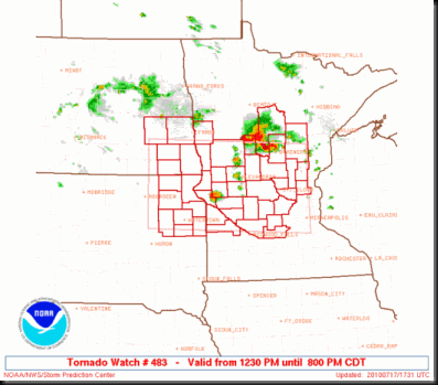
My initial chase target late Friday night/early Saturday morning was Benson, MN based on what the 4.0km WRF model was telling me. Storms started firing around the Alexandria and St. Cloud areas along I-94, north of a warm front, after the noon hour. It was a little surprising to see storms firing so early in the day and the proximity to the Twin Cities. That caught me off-guard a little bit with the differences in what the model data was telling me. This activity was east of what I felt were the greatest dynamics for tornadoes, so I asked myself how this could be happening. Going into Saturday morning, I expected to see storm development just east of the MN/ND/SD border sometime after 2 PM local time with movement to the east-southeast. Scraping my plans to head west, I began my trek up towards I-94 towards St. Cloud. Not long into my journey, a tornado watch was issued at around 12:30 PM until 8 PM, which included most of central MN. The watch got as close to the Cities as Wright Co., but a few of the immediate Twin Cities metro counties were added later as the watch boundaries were extended.
As I travelled towards the Albertville area on I-94, I started loosing confidence in this cell north and west of St. Cloud as it began to get so massive. Still north of I-94, this cell appeared to evolving into a heavy rain and hail producer with a funnel cloud report mixed in near Gull Lake around 12:45 PM. I’m not one who likes to sit underneath or punch into cores containing large hail. It damages your vehicle unnecessarily and jeopardizes my safety with the possibility of windows breaking and being injured by broken glass. Just don’t understand it, but that’s my prerogative, just as it is for those who drive or sit idle through it. How to chase is up to each individual. Digressing from that tangent - since these cells were outside of what I felt was the greatest dynamics for the possibility of a tornado, I decided to leave this cell and head back south and take US-12 out west to intercept some storms heading for Willmar. Based on CAPE values and wind shear, I took a gamble that these storms would intensify rapidly and possibly produce a tornado.
I caught up with some storms in Wright Co that I followed for an hour west to east from Cokato to near Buffalo before they died out. The storms near St. Cloud were still maintaining their intensity, so I decided to head north on Hwy 25 in Buffalo to check it out.
![1%20a%20a%20wunder2-thumb-500x325[1] 1%20a%20a%20wunder2-thumb-500x325[1]](https://blogger.googleusercontent.com/img/b/R29vZ2xl/AVvXsEixNb9HT1utaH-LuLfJYKVbpC_I6hGTKOCI5VAr0pBNyN7uLE-ZFVFUBocFK-IZU8UWBvZ-cv7y6JswmUKZiYzvXf548teJFoQgTvaNTs-o6UT7BoZ7celMey3_TiyvdQZQbP3SSfvWs74/?imgmax=800)
Around 2:30 PM, the St. Cloud storm was beginning to move south of I-94 and move in a southeasterly direction towards the Twin Cities as it picked up speed along the warm front that was slowly sagging to the south.

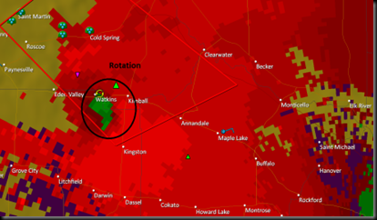
Made the decision to stay east of the cell and attempted to stay in front of it taking the State Highway 15 south exit on I-94 around 3:35-3:40 PM. The cell was tornado warned at 3:28 PM and heading in my direction. Greatest area of concern was around Eden Valley and Watkins. Attempting to cross in front of the cell so I could get in position on the backside of the cell before being dumped on with heavy rains in hail, I arrived near Kimball, MN around 3:45 PM.
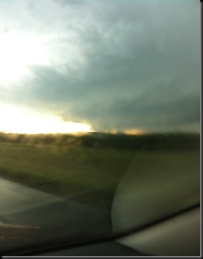
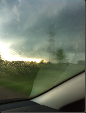
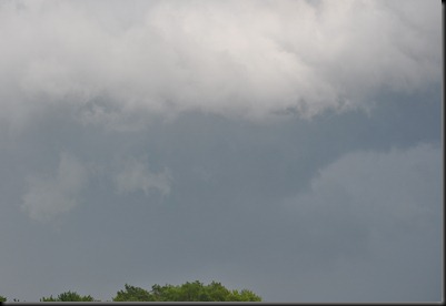
Above are pictures taken from 3:44 to 3:46 PM from my phone inside the car near Kimball, MN looking north and west. It was a very mature supercell with strong updrafts and one report of 4.25” inch hail as it came through Sauk Center at 3:37 PM. Not a storm to be stuck standing in front of you.

About a half hour later, I continued trekking south on Highway 15 through heavy rains, winds, and some pea to dime size hail as the activity moved through Kimball towards Kingston Township. Wanting to get out of the rain and get some photo opportunities I turned off onto a county road west of Kingston to spend some time with the Nikon camera.
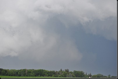
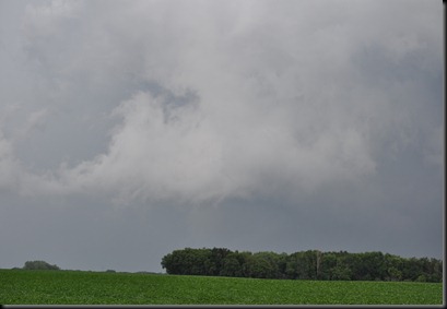
These pictures were taken looking east from my position, which was just southwest of Kingston. As I began shooting pictures around 4:15 PM, a tornado was reported 2 miles southeast of town just a minute later. I could not locate the tornado from my position, but there definitely were a lot of low hanging clouds. In this high precipitation supercell, it was tough to get a clean look at much of anything this day. A local passed me by as I was taking pictures, and asked if I was a storm chaser and wanted to know what specifically is a wall cloud. I tried to explain to the best of my abilities without having a visual to show him and also not boring him with technical jargon. It’s nice to run into people that take an appreciation of the weather and want to learn more about it. Although I didn’t recommend it at the time, hopefully this person takes enough interest to sign up for a Skywarn class. The system could definitely use all the trained eyes it can get. Meeker County gets a fair amount of storms each year, so each individual provides a great service to it’s community.
Leaving the Kingston area, I continued following the west side of this cell as it moved through Meeker, Wright, and Carver Counties through the 4 and 5 PM hour. Made another stop for pictures at 4:55 PM in far northeastern McLeod County, a couple miles north of Winsted, MN. Incidentally, an EF-0 tornado touched down in this vicinity back on June 17th.
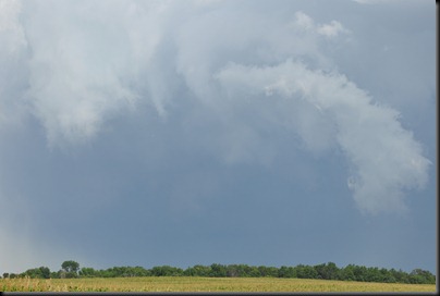
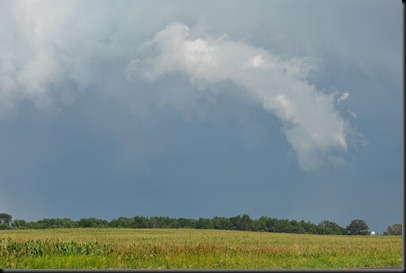
Photos from north of Winsted, MN looking east towards Watertown, MN (8 miles away). Two minutes after stopping, at 4:57 PM, spotters reported a tornado 3 miles west of Watertown. Again, I could not see this tornado from my vantage point. From what I could tell, the lowering to the right was merely scud as it appeared to be disconnected from the thunderstorm base. Can’t really speculate as to whether this was being reported as a tornado or not. Watching this for a few minutes, I didn’t see anything worthwhile to stick around for, so I hopped back into the car and met up with State Highway 7 south of Winsted.
Some more pictures taken along Highway 7 as the storm bared down on Waconia, Victoria, Chanhassen, and Chaska. The supercell started to really fall apart east of Mound and no longer posed much of a tornado threat by 5:45 PM. This is where I called off the chase.
Finally, I will leave you with some chase video I shot from my dash cam along Hwy 7 as seen streamed live on Severe Studios. Notice how many locals were out watching the storm. Overall, people handled themselves really well. Cars were parked on the side of the road and traffic was kept moving, albeit slow, since everyone was watching the sky, which I can understand. It sure beats hearing stories of chasers passing cars at 100 MPH and passing up inclines with an obstructed view of traffic heading towards them. Enjoy the video!
Miles: Approximately 350
Reports submitted: 0
RS







Sorry it took so long to tell you this but nice job on this post and Randy wanted me to tell you the same thing that he liked this post
ReplyDelete