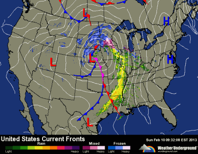
A winter storm will impact the region late Thursday into Friday as an area of low pressure will move in from the panhandle of Texas and Oklahoma – known as a “Panhandle Hooker”. Snow will wrap around the northern and eastern sides as the low travels into southern Wisconsin Friday.
Snow will begin to fall Thursday evening across southern Minnesota, and taper by mid-day Friday. The limiting factor with this system will be available moisture. Severe thunderstorms across the Deep South will steal a bit of the energy to prevent our snows from being 12 inches or more, but I think we will still see somewhere in the four to six inch range for snow totals. The area where I believe the heaviest concentrated snow will occur in Minnesota is highlighted below.
A Winter Storm Watch has been posted from Thursday into Friday afternoon for the counties below.
Travel will be difficult late Thursday into Friday, so prepare for slow commutes, and allow extra time.
RS


