Sunday, September 25, 2011
StormChaser Schwartz hits milestone
When I started this blog over a year and a half ago, I had no idea what kind of audience I would be able to generate over time. The blog has slowly evolved with enhancements, and now is a full-blown website. The latest addition to StormChaser Schwartz is automated weather warnings that will post on both the Facebook blog page and Twitter feed. Just another reason to “like” the Facebook page and follow the blog on Twitter!
RS
Minnesota Fall color chasing 2011
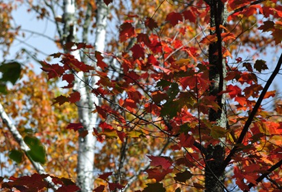
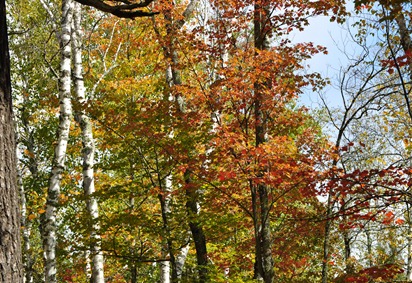
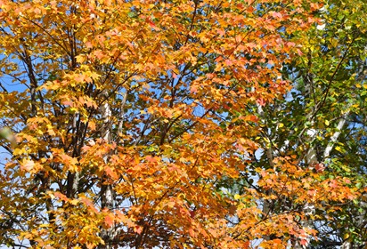
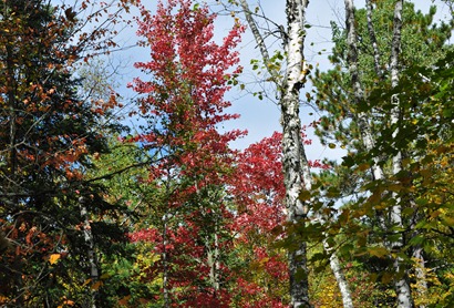
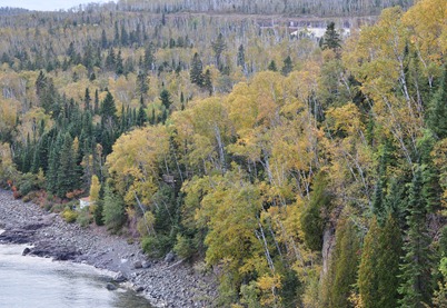
On Friday, I took a day trip up to northern Minnesota to take in some of the fall colors that are now occurring.
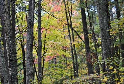
My destination for this day was Bear Head Lake State Park, located about 15 miles southwest of Ely. It is right on the fridge of where the best colors are being indicated by the Minnesota Department of Natural Resources.
Here are some of the sights as I walked along the park’s Norberg hiking trail: (Click photos for larger images)
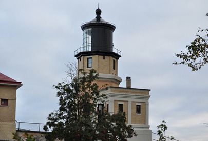
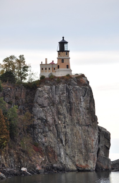
I ended the day by stopping at Split Rock Lighthouse State Park in Two Harbors along the north shore to grab some pictures of the lighthouse near sunset. Unfortunately, the clouds were pretty thick, but took some photos nonetheless:
I spent nearly 10 hours in car this day, but it was worth it to capture some of the best that nature has to offer. This only happens once in a year. With a quick peak color season possible this year, there is just the slightest window to get out and take it all in!
RS
Tuesday, September 13, 2011
Freeze warning
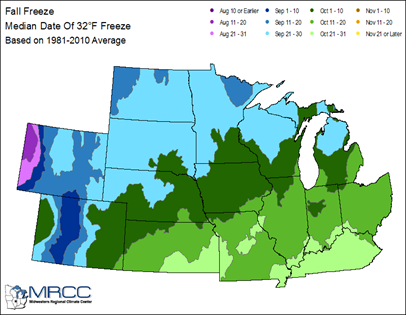
The first freeze warning of the fall/winter 2011 season is upon us earlier than usual for Thursday morning. According to the Midwestern Regional Climate Center, we are about three week behind schedule for the first 32-degree or lower temperature.
A Freeze Warning is in effect from 12:00 AM CDT Thursday until 8:00 AM CDT Thursday for the southwestern half of Minnesota with a Freeze Watch across the northern sections of Minnesota for the same duration.
As I mentioned in the previous post, this cool air will not stick around, and we’ll see these chilly temperatures vanish by late in the week/early next week when we return to seasonal norms.
RS
Monday, September 12, 2011
Cool down coming, but will only be temporary
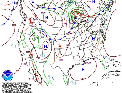
Our extended summer looks like it will come to an end this week as a couple shots of artic air work their way into the Upper Midwest during the first half of the week. Monday’s high temperature in the Twin Cities topped off at 90-degrees, which is the third 90-degree plus reading this month. On September 1, MSP had a high of 94 and September 9 had a high of 90. Monday will be the final day of the a series of cold fronts move through the area.
Round one of the cool blast comes tonight and will drop temperatures nearly 20-degrees:
Round two happens Tuesday night as a secondary cold front moves through and may drop temperatures another 10-degrees.
Frost and freeze conditions may be possible across the Twin Cities on Thursday morning before we rebound back to seasonal temperatures next week in the 70s. This cool air is not sticking around.
It does look like we have seen our final 90s of the year and the end of summer-like weather. Looking ahead to the final weeks of September, early indications are that temperatures will predominately be near normal with 60s and 70s in the area.
RS
Sunday, September 11, 2011
Remembering 9/11

I am going to stray off the usual weather topics with this blog post today. Since it is the 10th anniversary of the September 11, 2001 attacks, I thought it would a good time to reflect and look back to the day our country changed forever.
10 years ago, I was a college senior at the University of Wisconsin – Eau Claire. Rolled out of bed that morning thinking it was going to be just another ordinary day: going to class, working on homework, etc. Did not turn on the television before class, so I had no idea what was happening along the east coast at that moment. As I arrived at my 9 AM accounting class, I overheard chatter between students that something terrible occurred in New York City and there was damage to the World Trade Center building. Classmates were a bit shocked and confused over the event, that I still did not have all the details of what transpired. Nobody really wanted to talk about it. It was not until I could get to a computer between classes that I got a better context of the events that occurred on this tragic day, and later with the nightly news specials on television. I do not even remember if classes were cancelled that day. Just trying to comprehend the attacks seemed to fill my memory bank.
We were witnessing this generation’s Pearl Harbor attack. While trying to comprehend the magnitude and sadness over the loss of life, one thing was clear - this was an act of war. The images of the towers collapsing with the smoke and soot everywhere are still fused into my memory. Seeing people jump from windows to escape the World Trade Center, or else be burned, can’t be put into words. it changed how we view national security forever. No more “loosey-goosey”, lax policies. We lost a bit of freedom that we had to fight to get back. It made me realize that freedom is not free and it forever will be an on-going battle to retain it.
RS
Saturday, September 3, 2011
August weather summary and September outlook
August 2011 will be primarily known as dry month with just three days of significant rain. In the Twin Cities, we finished with 3.03-inches of rain this month, which is 1.27 inches below normal. This disagrees with the Climate Prediction Center outlook for August, which projected higher wetter than normal chances.
Across the state, precipitation was at or below normal from roughly St. Cloud, southward. Some areas picked up half or less as much rain than normal.
With the lack of rain across the southern parts of the state, it has resulted in minor drought conditions. Dry conditions also persist across the arrowhead of Minnesota.
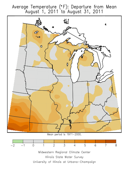
During the month, we saw temperatures into the 80s largely with really no hints of autumn in the air. Considering the snowy and cold conditions we experienced to begin the year, I think it’s safe to say we’ve appreciated what Mother Nature has brought us to conclude the end of the meteorological summer. In the Twin Cities, the average monthly temperature for August is 71.2-degrees, and we finished the month 2.4-degrees above normal. The Climate Prediction Center projected close to normal temperatures during the month.
Looking at temperature across the state during the month, most of the state was at normal or slightly above normal, with above normal numbers the highest north of the Interstate 94 corridor.
So what is September looking like? Temperatures are expected to be typical for the month. The average monthly temperature is 68-degrees.
We began September and the start to the meteorological fall with a high temperature of 94-degrees, which happened to be warmer than anything that occurred during August. Temperatures this week are expected to settle into a more fall-like pattern with highs between 70 and 80 through most of next week.
As far as precipitation chances go, a dry month is expected with high probabilities of below normal conditions.
If the forecast holds, our ground won’t have nearly the moisture content heading into the winter months as it did last year to alleviate some of the spring flooding concern. Fall flooding shouldn’t be a problem this year. Farmers will be hurt, however, with the lack of moisture for fall crop harvest season, such as pumpkins. This year’s apple crop is expected to be good due to abundant rainfall early to the year and sunshine late in the growing season, but still need rain for the crop to finish strong.
RS


