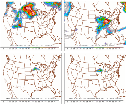
An active weather day setting up for Thanksgiving eve across Minnesota. The state will see everything from freezing rain, sleet, to snow. This is because the snow/rain line will be meandering across the southern half of Minnesota throughout the day on Wednesday, which has made it a challenge to forecast what exactly what will happen and where. Looking at the SREF P-Type runs, it appears the greatest precip potential will be ice pellets (sleet) for the southern part of the Twin Cities metro to Worthington, MN, and La Crosse, WI. Snow will be the dominate player for the rest of the state with freezing rain near the Minnesota and Iowa border.
Winter Weather Advisory is in effect for the purple shaded counties below until midnight.
Snow totals. For locations that see all snow, I'm forecasting about 3-4 inches of snow (north metro over to Eau Claire, WI) with 8 inches possible up by the north shore. Areas that see sleet, will have that total reduced substantially, with perhaps in inch or two of snow after the changeover.
Drive safe and give yourself extra time if you need to travel today.
Happy Thanksgiving!
RS


No comments:
Post a Comment